These records are found in the online catalog of The Mariners’ Museum and Park in Newport News, Virginia. Uncurated search results are presented to give researchers and interested readers an idea of whether the museum’s archives contain information about this vessel and whether it may be worthwhile to visit the museum’s catalog search page for further investigation. Uncurated results may be inaccurate or incomplete.
Mariners Museum online catalog search, July 12, 2026. Search phrase: "Traveller". Catalog returned 63 records; this selection table includes 63 records fetched through catalog result pages.
Use these buttons to send uncurated search results to your own app or text document for further research. First, check the box for any row, or click "Select All" then uncheck any rows. Then click "Show Selections". You can then copy your selections from the text box and past them into your app.
BOSTON - MASSACHUSETTS - UNITED STATES - Manufacturer
NOTES: These items were from a 14-1/2' sailing dinghy, midshipmate class by Whittier & Low, Ipswich, Massachusetts. This equipment was made by Merriman, Boston, Massachusetts. Built in 1937. A pintle is the heavy pins or bolts on the forward edge of the rudder frame, by which the rudder is hinged to the gudgeons of the stern or rudderpost, around which it pivots. NOTES: Merriman Brothers started in Boston in 1898 their rigging loft and blockmakers factory in Amory Street. They were Edward Butler Merriman, born 1867, and Frank White Merriman, born in 1873. They specialized in pulley blocks and fittings an became rather famous all over the world with the name "Merriman Bros", trademark a Trident. INVENTORY: Gudgeon on traveller - there is one (1) component part.
Polynesia–History.; Polynesia–Description and travel.
Pacific history series ; no. 2
The works of Ta'unga : - records of a Polynesian traveller in the South Seas, 1833-1896 - edited by R. G. and Marjorie Crocombe, with annotations by Jean Guiart, Neil Gunson and Dorothy Shineberg
Yemen (Republic)–Description and travel–Early works to 1800.; Mecca (Saudi Arabia)–Description and travel–Early works to 1800.; Saudi Arabia–Description and travel–Early works to 1800.
Works issued by the Hakluyt Society ; 3rd ser., no. 19
"Published by Ashgate for The Hakluyt Society, London."
SHORT DESCRIPTION: Flush-decked steel cargo vessel with five hatches, single funnel, two masts and one pair king posts with cargo booms, (one hatch with king posts in the center of split superstructure), small after deck house, guns, life rafts, highly detailed deck machinery, fittings, and gear. Painted uniformly dark gray above water line (which is very low, essentially at level of propeller shaft); copper red below. No name on hull, in accord with wartime practice. Listed as a "builder's model" due to Gibbs & Cox origins. However, the model is late to have been part of the design and construction process, since it is dated December 1, 1942, while the actual OCEAN TRAVELLER was built two months earlier and the first of the class (OCEAN VANGUARD) in October 1941. Note that modelmaker used American spelling of "TRAVELER" on nameboard, while the ship was registered as OCEAN TRAVELLER, using the British "LL" spelling. VESSEL INFORMATION- VESSEL NAME: OCEAN TRAVELLER ALL NAMES OF VESSEL: 1) OCEAN TRAVELLER (1942); 2) CAPE CORSO (1947) NATIONALITY: BRITISH HOME PORT: LIVERPOOL VESSEL TYPE: DRY CARGO OFFICIAL NUMBER: 168838 (br.) HULL NUMBER: VESSEL DIMENSIONS: 425.1' X 57.0' X 34.8' SERVICE DATES: 1942-1959 SHIPBUILDER: TODD-BATH IRON SHIPBUILDING CORPORATION SHIPBUILDER LOCATION: MAINE, SOUTH PORTLAND ENGINE BUILDER: DOMINION ENGINEERING WORKS, LTD. ENGINE BUILDER LOCATION: CANADA, MONTREAL SHIP OWNERS: MINISTRY OF WAR TRANSPORT SHIP LINE OR OPERATOR: LYLE SHIPPING CO., LTD., MGRS. CAPTAINS OR OTHER RELATED PEOPLE: MAJOR EVENTS: VESSEL HISTORY: DATE SCRAPPED: 1959 PLACE OF SCRAPPING: HONG KONG ASSOCIATED (RELATED?) PLACES: RELATED VESSELS: 59 sister ships in "Ocean" class built for the British Ministry of War Transport, 1941-1942. The same Gibbs & Cox design was adapted and modified for the United States' "Liberty Ship" program, eventually producing over 2,700 ships; the hulls appear identical, although the superstructures are very different. LABEL COPY: OCEAN TRAVELLER Gibbs & Cox, builder Scale: 1 to 48 Gift of Mr. Frederick H. Gibbs, 1973.1 In September 1940, representatives of the British Merchant Shipbuilding Mission came to the United States to order ships. The resulting Ocean class, to which OCEAN TRAVELLER belongs, became the prototype in hull design for the American Liberty ship. (CARRIERS 10-20-95, PG 8) CURATOR'S NOTES: Richard Malley, July 9, 1987 Some docents have noted a discrepancy in the spelling of the name of the British cargo ship OCEAN TRAVELLER in Seapower. The nameboard on the model is spelled OCEAN TRAVELER, while the label copy refers to OCEAN TRAVELLER. In fact the label is correct, and the nameboard is incorrect. Americans spell Traveler with one "l", while the British use a double "l" configuration. Many dictionaries list both spellings. This is just another example of two peoples separated by a common language!.
The universal traveller: - or, A compleat description of the several nations of the world ... Brought down to the present time. - And illustrated with a great variety of maps and cuts. By Mr. Salmon
The universal traveller : - designed to introduce readers at home to an acquaintance with the arts, customs, and manners of the principal modern nations on the globe
United States–Description and travel; Canada–Description and travel.; Great Britain–Colonies–America
Dedication signed in manuscript, Alexr. Clunie. In another issue, having same imprint, the dedication has printed signature: The American traveller. Map has title: A map of North & South America, with part of Europe, Asia & Africa. By the American traveller. T. Jefferys sculpt. 70 x 52 cm.
Armored vessels–Designs and plans.; Books–Reviews.
Sample cover of de Rohan's book, "Designs for Sea-going Iron-clad Ships of War". Three clippings from The Globe and Traveller, the Naval and Military Gazette, and the United Service Gazette are pasted on the verso. The clippings discuss and provide opinions on de Rohan's research and his designs for ironclad vessels. They include manuscript marks by de Rohan.
A treatise on nautical surveying : - containing an outline of the duties of the naval surveyor ; with cases applied to naval evolutions and miscellaneous rules and tables useful to the seaman or traveller - by Commander Edward Belcher
Newfoundland and Labrador–Description and travel.; Labrador (N.L.)–Description and travel.
Voyage of His Majesty's ship Rosamond to Newfoundland and the southern coast of Labrador, of which countries no account has been published by any British traveller since the reign of Queen Elizabeth - by Lieut Edward Chappell, R.N. ..
NOTES: VIEW OF LIVERPOOL IN LANCASHIRE. From: "BURLINGTON (Charles)" & OTHERS: - THE MODERN UNIVERSAL BRITISH TRAVELLER; OR, A NEW, COMPLETE, AND ACCURATE TOUR THROUGH ENGLAND, WALES, SCOTLAND, AND THE NEIGHBOURING ISLANDS ... ; Published London: for J. Cooke, 1779. First edition, in book form (originally published in eighty weekly parts). The plainly fictitious "Charles Burlington" and his fellow ghosts "Alexander Murray" and "David Llewellyn Rees" (who nominally contribute the Scottish and Welsh sections respectively) offer an expansive and handsomely illustrated guide to everything "worthy of observation in Great Britain", intended "to please the Polite, - entertain the Curious, instruct the Uninformed, - and direct the Traveller". The extensive text, in truth probably compiled by the querulous Robert Sanders, gives a complete synopsis of to country - a general survey, material on local and natural history, antiquities, etc., as well as coverage of government and biographies of local worthies. The work is particularly valued for the wealth of illustral material - with some thirty fine panoramic prospects of the principal towns and cities, and over seventy further views of other towns, the great houses, the natural features and the picturesque ruins. To these are added an emblematic frontispiece of Britannia, three historical plates after Samuel Wale, a map of Great Britain (by Thomas Bowen) and a road map of England and Wales. Crown folio. 836,[xviii]pp. Engraved frontispiece,two maps and 105 plates. SEE: LE 0444, LE 0175, LE 0853, LE 0855, LE 0857, LE 0994, LE 1042, LE 1974, LE 1975, LE 1976, LE 1977, LE 1978.
NOTES: VIEW OF ISLEWORTH FROM RICHMOND GARDENS; From: "BURLINGTON (Charles)" & OTHERS: - THE MODERN UNIVERSAL BRITISH TRAVELLER; OR, A NEW, COMPLETE, AND ACCURATE TOUR THROUGH ENGLAND, WALES, SCOTLAND, AND THE NEIGHBOURING ISLANDS ... ; Published London: for J. Cooke, 1779. First edition, in book form (originally published in eighty weekly parts). The plainly fictitious "Charles Burlington" and his fellow ghosts "Alexander Murray" and "David Llewellyn Rees" (who nominally contribute the Scottish and Welsh sections respectively) offer an expansive and handsomely illustrated guide to everything "worthy of observation in Great Britain", intended "to please the Polite, - entertain the Curious, instruct the Uninformed, - and direct the Traveller". The extensive text, in truth probably compiled by the querulous Robert Sanders, gives a complete synopsis of to country - a general survey, material on local and natural history, antiquities, etc., as well as coverage of government and biographies of local worthies. The work is particularly valued for the wealth of illustral material - with some thirty fine panoramic prospects of the principal towns and cities, and over seventy further views of other towns, the great houses, the natural features and the picturesque ruins. To these are added an emblematic frontispiece of Britannia, three historical plates after Samuel Wale, a map of Great Britain (by Thomas Bowen) and a road map of England and Wales. Crown folio. 836,[xviii]pp. Engraved frontispiece,two maps and 105 plates. SEE: LE 0444, LE 0175, LE 0853, LE 0855, LE 0857, LE 0994, LE 1042, LE 1974, LE 1975, LE 1976, LE 1977, LE 1978.
NOTES: From: "BURLINGTON (Charles)" & OTHERS: - THE MODERN UNIVERSAL BRITISH TRAVELLER; OR, A NEW, COMPLETE, AND ACCURATE TOUR THROUGH ENGLAND, WALES, SCOTLAND, AND THE NEIGHBOURING ISLANDS ... ; Published London: for J. Cooke, 1779. First edition, in book form (originally published in eighty weekly parts). The plainly fictitious "Charles Burlington" and his fellow ghosts "Alexander Murray" and "David Llewellyn Rees" (who nominally contribute the Scottish and Welsh sections respectively) offer an expansive and handsomely illustrated guide to everything "worthy of observation in Great Britain", intended "to please the Polite, - entertain the Curious, instruct the Uninformed, - and direct the Traveller". The extensive text, in truth probably compiled by the querulous Robert Sanders, gives a complete synopsis of to country - a general survey, material on local and natural history, antiquities, etc., as well as coverage of government and biographies of local worthies. The work is particularly valued for the wealth of illustral material - with some thirty fine panoramic prospects of the principal towns and cities, and over seventy further views of other towns, the great houses, the natural features and the picturesque ruins. To these are added an emblematic frontispiece of Britannia, three historical plates after Samuel Wale, a map of Great Britain (by Thomas Bowen) and a road map of England and Wales. Crown folio. 836,[xviii]pp. Engraved frontispiece,two maps and 105 plates. SEE: LE 0444, LE 0175, LE 0853, LE 0855, LE 0857, LE 0994, LE 1042, LE 1974, LE 1975, LE 1976, LE 1977, LE 1978.
NOTES: From: "BURLINGTON (Charles)" & OTHERS: - THE MODERN UNIVERSAL BRITISH TRAVELLER; OR, A NEW, COMPLETE, AND ACCURATE TOUR THROUGH ENGLAND, WALES, SCOTLAND, AND THE NEIGHBOURING ISLANDS ... ; Published London: for J. Cooke, 1779. First edition, in book form (originally published in eighty weekly parts). The plainly fictitious "Charles Burlington" and his fellow ghosts "Alexander Murray" and "David Llewellyn Rees" (who nominally contribute the Scottish and Welsh sections respectively) offer an expansive and handsomely illustrated guide to everything "worthy of observation in Great Britain", intended "to please the Polite, - entertain the Curious, instruct the Uninformed, - and direct the Traveller". The extensive text, in truth probably compiled by the querulous Robert Sanders, gives a complete synopsis of to country - a general survey, material on local and natural history, antiquities, etc., as well as coverage of government and biographies of local worthies. The work is particularly valued for the wealth of illustral material - with some thirty fine panoramic prospects of the principal towns and cities, and over seventy further views of other towns, the great houses, the natural features and the picturesque ruins. To these are added an emblematic frontispiece of Britannia, three historical plates after Samuel Wale, a map of Great Britain (by Thomas Bowen) and a road map of England and Wales. Crown folio. 836,[xviii]pp. Engraved frontispiece,two maps and 105 plates. SEE: LE 0444, LE 0175, LE 0853, LE 0855, LE 0857, LE 0994, LE 1042, LE 1974, LE 1975, LE 1976, LE 1977, LE 1978.
NOTES: From: "BURLINGTON (Charles)" & OTHERS: - THE MODERN UNIVERSAL BRITISH TRAVELLER; OR, A NEW, COMPLETE, AND ACCURATE TOUR THROUGH ENGLAND, WALES, SCOTLAND, AND THE NEIGHBOURING ISLANDS ... ; Published London: for J. Cooke, 1779. First edition, in book form (originally published in eighty weekly parts). The plainly fictitious "Charles Burlington" and his fellow ghosts "Alexander Murray" and "David Llewellyn Rees" (who nominally contribute the Scottish and Welsh sections respectively) offer an expansive and handsomely illustrated guide to everything "worthy of observation in Great Britain", intended "to please the Polite, - entertain the Curious, instruct the Uninformed, - and direct the Traveller". The extensive text, in truth probably compiled by the querulous Robert Sanders, gives a complete synopsis of to country - a general survey, material on local and natural history, antiquities, etc., as well as coverage of government and biographies of local worthies. The work is particularly valued for the wealth of illustral material - with some thirty fine panoramic prospects of the principal towns and cities, and over seventy further views of other towns, the great houses, the natural features and the picturesque ruins. To these are added an emblematic frontispiece of Britannia, three historical plates after Samuel Wale, a map of Great Britain (by Thomas Bowen) and a road map of England and Wales. Crown folio. 836,[xviii]pp. Engraved frontispiece,two maps and 105 plates. SEE: LE 0444, LE 0175, LE 0853, LE 0855, LE 0857, LE 0994, LE 1042, LE 1974, LE 1975, LE 1976, LE 1977, LE 1978.
NOTES: VIEW OF PUTNEY & FULHAM FROM Mr NANNECK'S; From: "BURLINGTON (Charles)" & OTHERS: - THE MODERN UNIVERSAL BRITISH TRAVELLER; OR, A NEW, COMPLETE, AND ACCURATE TOUR THROUGH ENGLAND, WALES, SCOTLAND, AND THE NEIGHBOURING ISLANDS ... ; Published London: for J. Cooke, 1779. First edition, in book form (originally published in eighty weekly parts). The plainly fictitious "Charles Burlington" and his fellow ghosts "Alexander Murray" and "David Llewellyn Rees" (who nominally contribute the Scottish and Welsh sections respectively) offer an expansive and handsomely illustrated guide to everything "worthy of observation in Great Britain", intended "to please the Polite, - entertain the Curious, instruct the Uninformed, - and direct the Traveller". The extensive text, in truth probably compiled by the querulous Robert Sanders, gives a complete synopsis of to country - a general survey, material on local and natural history, antiquities, etc., as well as coverage of government and biographies of local worthies. The work is particularly valued for the wealth of illustral material - with some thirty fine panoramic prospects of the principal towns and cities, and over seventy further views of other towns, the great houses, the natural features and the picturesque ruins. To these are added an emblematic frontispiece of Britannia, three historical plates after Samuel Wale, a map of Great Britain (by Thomas Bowen) and a road map of England and Wales. Crown folio. 836,[xviii]pp. Engraved frontispiece,two maps and 105 plates. SEE: LE 0444, LE 0175, LE 0853, LE 0855, LE 0857, LE 0994, LE 1042, LE 1974, LE 1975, LE 1976, LE 1977, LE 1978.
NOTES: ADMIRAL LORD CHARLES WILLIAM DE LA POER BERESFORD, C.B., M.P. The eldest surviving son of the fourth Marquis of Waterford, who is the oldest uncle of the present Lord Waterford, has done much to brighten the name of his house ashore, at sea, and in Parliament. His social virtues are genial and breezy; his seamanship is believed in; his reckless pluck and readiness are well proven; and his Politics are strong and hearty. Now he has added another quality - that of the business man - so energetically that he is called "The Commercial Traveller." For he has been "doing" China with all the energy that is one of his attributes; and he has put his experiences in that more or less to be divided part of the world into a book that is written from the point of view not of the sailor or politician, but of the Business Man. And some people hope that good to the British Empire will result. He is a good creature. Full of blunt Irish geniality, he has made himself very well known.
Egypt–Description and travel–Early works to 1800; Arabian Peninsula–Description and travel–Early works to 1800
Voyages and travels–Early works to 1800.
A series of adventures in the course of a voyage up the Red-Sea, on the coasts of Arabia and Egypt : - and of a route through the desarts of Thebais, hitherto unknown to the European traveller, in the year M.DCC.LXXVII. in letters to a lady - by Eyles Irwin, esq. ; illustrated with maps and cuts
NOTES: From: "BURLINGTON (Charles)" & OTHERS: - THE MODERN UNIVERSAL BRITISH TRAVELLER; OR, A NEW, COMPLETE, AND ACCURATE TOUR THROUGH ENGLAND, WALES, SCOTLAND, AND THE NEIGHBOURING ISLANDS ... ; Published London: for J. Cooke, 1779. First edition, in book form (originally published in eighty weekly parts). The plainly fictitious "Charles Burlington" and his fellow ghosts "Alexander Murray" and "David Llewellyn Rees" (who nominally contribute the Scottish and Welsh sections respectively) offer an expansive and handsomely illustrated guide to everything "worthy of observation in Great Britain", intended "to please the Polite, - entertain the Curious, instruct the Uninformed, - and direct the Traveller". The extensive text, in truth probably compiled by the querulous Robert Sanders, gives a complete synopsis of to country - a general survey, material on local and natural history, antiquities, etc., as well as coverage of government and biographies of local worthies. The work is particularly valued for the wealth of illustral material - with some thirty fine panoramic prospects of the principal towns and cities, and over seventy further views of other towns, the great houses, the natural features and the picturesque ruins. To these are added an emblematic frontispiece of Britannia, three historical plates after Samuel Wale, a map of Great Britain (by Thomas Bowen) and a road map of England and Wales. Crown folio. 836,[xviii]pp. Engraved frontispiece,two maps and 105 plates. SEE: LE 0444, LE 0175, LE 0853, LE 0855, LE 0857, LE 0994, LE 1042, LE 1974, LE 1975, LE 1976, LE 1977, LE 1978.
NOTES: From: "BURLINGTON (Charles)" & OTHERS: - THE MODERN UNIVERSAL BRITISH TRAVELLER; OR, A NEW, COMPLETE, AND ACCURATE TOUR THROUGH ENGLAND, WALES, SCOTLAND, AND THE NEIGHBOURING ISLANDS ... ; Published London: for J. Cooke, 1779. First edition, in book form (originally published in eighty weekly parts). The plainly fictitious "Charles Burlington" and his fellow ghosts "Alexander Murray" and "David Llewellyn Rees" (who nominally contribute the Scottish and Welsh sections respectively) offer an expansive and handsomely illustrated guide to everything "worthy of observation in Great Britain", intended "to please the Polite, - entertain the Curious, instruct the Uninformed, - and direct the Traveller". The extensive text, in truth probably compiled by the querulous Robert Sanders, gives a complete synopsis of to country - a general survey, material on local and natural history, antiquities, etc., as well as coverage of government and biographies of local worthies. The work is particularly valued for the wealth of illustral material - with some thirty fine panoramic prospects of the principal towns and cities, and over seventy further views of other towns, the great houses, the natural features and the picturesque ruins. To these are added an emblematic frontispiece of Britannia, three historical plates after Samuel Wale, a map of Great Britain (by Thomas Bowen) and a road map of England and Wales. Crown folio. 836,[xviii]pp. Engraved frontispiece,two maps and 105 plates. SEE: LE 0444, LE 0175, LE 0853, LE 0855, LE 0857, LE 0994, LE 1042, LE 1974, LE 1975, LE 1976, LE 1977, LE 1978.
NOTES: "View of the Town & Harbour of Portsmouth in Hampshire", anonymous engraver, published in Walpoole's New and Complete British Traveller, London, about 1784.
NO. 17, AT SHAKESPEARE'S HEAD, PATERNOSTER ROW - LONDON - ENGLAND - Publisher; PORTSMOUTH - ENGLAND - Related Place
NOTES: From: "BURLINGTON (Charles)" & OTHERS: - THE MODERN UNIVERSAL BRITISH TRAVELLER; OR, A NEW, COMPLETE, AND ACCURATE TOUR THROUGH ENGLAND, WALES, SCOTLAND, AND THE NEIGHBOURING ISLANDS ... ; Published London: for J. Cooke, 1779. First edition, in book form (originally published in eighty weekly parts). The plainly fictitious "Charles Burlington" and his fellow ghosts "Alexander Murray" and "David Llewellyn Rees" (who nominally contribute the Scottish and Welsh sections respectively) offer an expansive and handsomely illustrated guide to everything "worthy of observation in Great Britain", intended "to please the Polite, - entertain the Curious, instruct the Uninformed, - and direct the Traveller". The extensive text, in truth probably compiled by the querulous Robert Sanders, gives a complete synopsis of to country - a general survey, material on local and natural history, antiquities, etc., as well as coverage of government and biographies of local worthies. The work is particularly valued for the wealth of illustral material - with some thirty fine panoramic prospects of the principal towns and cities, and over seventy further views of other towns, the great houses, the natural features and the picturesque ruins. To these are added an emblematic frontispiece of Britannia, three historical plates after Samuel Wale, a map of Great Britain (by Thomas Bowen) and a road map of England and Wales. Crown folio. 836, [xviii]pp. Engraved frontispiece, two maps and 105 plates. SEE: LE 0444, LE 0175, LE 0853, LE 0855, LE 0857, LE 0994, LE 1042, LE 1974, LE 1975, LE 1976, LE 1977, LE 1978. NOTES: See pages 353-355 for the discussion of Portsmouth. The image appears after page 352.
ENGLAND; RELATED PLACE: ENGLAND, NEWCASTLE, TYNE RIVER
NOTES: From: "BURLINGTON (Charles)" & OTHERS: - THE MODERN UNIVERSAL BRITISH TRAVELLER; OR, A NEW, COMPLETE, AND ACCURATE TOUR THROUGH ENGLAND, WALES, SCOTLAND, AND THE NEIGHBOURING ISLANDS ... ; Published London: for J. Cooke, 1779. First edition, in book form (originally published in eighty weekly parts). The plainly fictitious "Charles Burlington" and his fellow ghosts "Alexander Murray" and "David Llewellyn Rees" (who nominally contribute the Scottish and Welsh sections respectively) offer an expansive and handsomely illustrated guide to everything "worthy of observation in Great Britain", intended "to please the Polite, - entertain the Curious, instruct the Uninformed, - and direct the Traveller". The extensive text, in truth probably compiled by the querulous Robert Sanders, gives a complete synopsis of to country - a general survey, material on local and natural history, antiquities, etc., as well as coverage of government and biographies of local worthies. The work is particularly valued for the wealth of illustral material - with some thirty fine panoramic prospects of the principal towns and cities, and over seventy further views of other towns, the great houses, the natural features and the picturesque ruins. To these are added an emblematic frontispiece of Britannia, three historical plates after Samuel Wale, a map of Great Britain (by Thomas Bowen) and a road map of England and Wales. Crown folio. 836,[xviii]pp. Engraved frontispiece,two maps and 105 plates. SEE: LE 0444, LE 0175, LE 0853, LE 0855, LE 0857, LE 0994, LE 1042, LE 1974, LE 1975, LE 1976, LE 1977, LE 1978.
NO. 17 SHAKESPEARE'S HEAD, PATERNOSTER ROW - LONDON - ENGLAND - Publisher; ABERDEEN - SCOTLAND - Related Place
NOTES: From "The Modern Universal British Traveller...", by Charles Burlington, David Llewellyn Rees, and Alexander Murray, published by J. Cooke, London 1779. After page 780.
First ed. published anonymously in 1834 under title: Things as they are, or, Notes of a traveller through some of the middle and northern states. Second ed. published under author's name in 1847 under title: Summer tours, or, Notes of a traveler.
"An advertisement to the reader" signed: R. G. [i.e. Rutherfoord Goodwin]. "Copyright [by] Colonial Williamsburg, inc." The physical make-up of the book is in 18th century style.
NO. 17, AT SHAKESPEARE'S HEAD, PATERNOSTER ROW - LONDON - ENGLAND - Publisher
NOTES: From: "BURLINGTON (Charles)" & OTHERS: - THE MODERN UNIVERSAL BRITISH TRAVELLER; OR, A NEW, COMPLETE, AND ACCURATE TOUR THROUGH ENGLAND, WALES, SCOTLAND, AND THE NEIGHBOURING ISLANDS ... ; Published London: for J. Cooke, 1779. First edition, in book form (originally published in eighty weekly parts). The plainly fictitious "Charles Burlington" and his fellow ghosts "Alexander Murray" and "David Llewellyn Rees" (who nominally contribute the Scottish and Welsh sections respectively) offer an expansive and handsomely illustrated guide to everything "worthy of observation in Great Britain", intended "to please the Polite, - entertain the Curious, instruct the Uninformed, - and direct the Traveller". The extensive text, in truth probably compiled by the querulous Robert Sanders, gives a complete synopsis of to country - a general survey, material on local and natural history, antiquities, etc., as well as coverage of government and biographies of local worthies. The work is particularly valued for the wealth of illustral material - with some thirty fine panoramic prospects of the principal towns and cities, and over seventy further views of other towns, the great houses, the natural features and the picturesque ruins. To these are added an emblematic frontispiece of Britannia, three historical plates after Samuel Wale, a map of Great Britain (by Thomas Bowen) and a road map of England and Wales. Crown folio. 836,[xviii]pp. Engraved frontispiece,two maps and 105 plates. SEE: LE 0444, LE 0175, LE 0853, LE 0855, LE 0857, LE 0994, LE 1042, LE 1974, LE 1975, LE 1976, LE 1977, LE 1978.
Navigation–History.; Indians–Origin.; English West Indian Expedition, 1739-1742.
The American traveller : - being a new historical collection carefully compiled from original memoirs in several languages, and the most authentic voyages and travels, containing a complet account of that part of the world, now called the West Indies, from its discovery by Columbus to the present time, illustrated with the head of the most eminent admirals, commanders, and travellers, neatly engraved, to which is prefixed an introduction, shewing the rise, progress, and improvement of navigation, the use and properties of the loadstone, and an enquiry concerning the first inhabitants of America : with an account of Admiral Vernons taking Porto Bello, Fort Chagre, and Carthagenna
NO. 17, AT SHAKESPEARE'S HEAD, PATERNOSTER ROW - LONDON - ENGLAND - Publisher; ST. MICHAEL'S MOUNT - CORNWALL - ENGLAND - Related Place
NOTES: From: "BURLINGTON (Charles)" & OTHERS: - THE MODERN UNIVERSAL BRITISH TRAVELLER; OR, A NEW, COMPLETE, AND ACCURATE TOUR THROUGH ENGLAND, WALES, SCOTLAND, AND THE NEIGHBOURING ISLANDS ... ; Published London: for J. Cooke, 1779. First edition, in book form (originally published in eighty weekly parts). The plainly fictitious "Charles Burlington" and his fellow ghosts "Alexander Murray" and "David Llewellyn Rees" (who nominally contribute the Scottish and Welsh sections respectively) offer an expansive and handsomely illustrated guide to everything "worthy of observation in Great Britain", intended "to please the Polite, - entertain the Curious, instruct the Uninformed, - and direct the Traveller". The extensive text, in truth probably compiled by the querulous Robert Sanders, gives a complete synopsis of to country - a general survey, material on local and natural history, antiquities, etc., as well as coverage of government and biographies of local worthies. The work is particularly valued for the wealth of illustral material - with some thirty fine panoramic prospects of the principal towns and cities, and over seventy further views of other towns, the great houses, the natural features and the picturesque ruins. To these are added an emblematic frontispiece of Britannia, three historical plates after Samuel Wale, a map of Great Britain (by Thomas Bowen) and a road map of England and Wales. Crown folio. 836,[xviii]pp. Engraved frontispiece,two maps and 105 plates. SEE: LE 0444, LE 0175, LE 0853, LE 0855, LE 0857, LE 0994, LE 1042, LE 1974, LE 1975, LE 1976, LE 1977, LE 1978. NOTES: The accompanying text reads: "This rock at high water forms an island, but upon the influx of the tide, the people walk to it on foot. At the foot of the mount is a noble and capacious pier, or mole, where a great number of ships may be safely laid up, cleaned, and repaired. The buildings on the top of the mount are formed with great propriety, being well adapted to the shape of the hill on which they land. The tower of the church is almost in the middle, and rises from the centre of the mountain's base, terminating the whole as a cone does a pyramid: the church, cells, and parapet walls spread themselves around the tower, as to cover the area or top of the hill, the hill-side enlarging itself gradually from the buildings downwards, till it comes near the sea, where it swells into a base of a mile in circumference, so that the most skilful architect could scarcely plan a structure that could better become the shape of this mountain. The situation is exceedingly agreeable, the rocky precipices from the sides of the mountain being wonderfully grand, and making a most beautiful contrast to the pleasant prospect of the villages and fruitful fields which surround and close Mount's Bay, so called from this Mount, as finding near its center, and making the most remarkable figure of any part of the circuit."- 502.
NOTES: This image may be from "The Universal traveller: or, a compleat description of the several nations of the world... Brough down to the present time. And Illustrated with a great variety of maps and cuts. By Mr. Salmon", by Thomas Salmon, London, Printed for R. Baldwin, 1752-1753. See TMM library Rare G114.S17 Oversize. Plate 8, No. 5, Page 9 is in Chapter II. G. Childe is the engraver. It is possible that it could also be by Jacob van der Schley for Antoine-François Prevost, ca 1750 but a comparable image could not be found.
LONDON - ENGLAND - Publisher; BEYKOZ - ISTANBUL - TURKEY - Related Place
SHORT DESCRIPTION: A view of the Bosporus looking north toward the Black Sea in the distance. The viewpoint is from Yuşa Tepesi, or Joshua’s Hill in English. On the right in the foreground there are two men herding goats on the hillside, and in the distance is a second hill, this one with the Yoros Castle at the summit. On the opposite side of the strait at the water’s edge is a mosque and minaret. The Bosporus and the Black Sea have many sailing ships in the water. NOTES: Image is plate 32 from “The Beauties of the Bosphorus by Miss Pardoe, Author of ‘The City of the Sultan,’ Illustrated in a series of Views of Constantinople and its Environs, from the original drawings by W. H. Bartlett.” This edition was published by James S. Virtue in 1840, but the book was first published in 1838 by his father, George Virtue. NOTES: The Yusa Tepesi (Joshua’s Hill) is reported to be the location of the gravesite of Joshua of the biblical stories. It is a sacred area for many religions, and has been the home to a mosque since 1755. It is known as the Giant’s Grave by some people because the fenced off area of the grave is more than 55 feet long. Yoros Castle possibly dates to the end of the 13th century during the Byzantine Empire. It was a strategic location to control the traffic through the Bosporus strait, and to defend the area. The castle changed hands several times, and the Genoese controlled it for almost 40 years in the early 1400s so it is now nicknamed the Genoese Castle. It fell into disrepair in the 1700s and is now an historic site. The town at the base of the hill below Yoros Castle is Anadolu Kavağı. An excerpt beginning on page 84 “The entrance to the Black Sea, as seen from the summit of the Jouchi-Daghi, or Giants’ Mountain, (the spot selected by the artist,) is the grandest coup-d’œil on the Bosphorus. As the line of shore terminates on either hand, the picturesque and jagged rocks suddenly yield to a low and sandy stretch of coast; and beyond are visible the “ Blue Symplegades,” heaving up their dark and irregular masses from the encircling waters of the Sea of Storms, which, stretching far away on all sides, is ultimately blent with the horizon. […] It is impossible to write of the Bosphorus without enthusiasm, for both its historical and fabulous associations serve to deepen its actual beauty; while the endless variety of its perspective keeps the eye and the mind continually on the stretch, never cheating either the one or the other of anticipated feast. Could it be contemplated in its entire length, and swept from sea to sea by one long gaze, much of its charm would be necessarily lost with its novelty; but as it winds in graceful curves between its enchanting shores, it is like a chain of cunningly wrought gold, of which, as it uncoils, every link appears more beautiful than the last. The caïque of the traveller is one moment overshadowed by the tall trees of the “Hill of the Thousand Nightingales,” and in the next instant it is darting past a brightly-painted palace; now it is with some difficulty urged forward against the eddying Sheitan Akindissi, or Devil’s Current, where the mad waves leap to its high and pointed prow; and now, as by some sudden spell it is again gliding over a surface blue, and clear, and almost rippleless. […] From the European side of the strait, immediately opposite the old Genoese Castle, the coup-d’œil is, perhaps, even more beautiful than on that of Asia, for the traveller commands from thence a scene of unparalleled variety, as he looks towards Constantinople.”
PENNSYLVANIA, PHILADELPHIA; RELATED PLACE: MICHIGAN, GRAND HAVEN
SHORT DESCRIPTION: Four-wheeled outfit in two sections, approximately 26ft in length when hooked together. One section has a brass Lyle gun mounted in the center of the rear axle with drums containing whip lines on each side of the gun. The front part of the outfit has a drum for hawser and also three shot line boxes. There are lights on each side of the driver's seat. The cart comes with one sand anchor, one breeches buoy, tongue and shafts and tripod for line. NOTES: This particular cart was used by the Coast Guard on the Great Lakes near Grand Haven, Michigan. It is of the same type as is used upon the Atlantic and Pacific coasts and at lifesaving stations throughout the world. When a wreck occurs fairly near shore, it is the purpose of the lifesavers to pass a rope from the shore to the ship and to haul along that rope a breeches buoy by means of which the survivors may be carried to safety. The apparatus consists of a cart in two sections; one section being a carriage for a lyle gun and reels of 1/2" line and the other a carriage for reels of heavy 1" line and miscellaneous equipment. When the wreck is sighted the cart is pulled by horse to a place on the beach opposite the wreck where it is uncoupled and set up for use. A projectile to which is attached a very light line, sometimes called the "rocket" line is fired to the ship by means of the lyle gun. In order for this light line to run freely, it is carefully and beautifully coiled upon wooden pegs in a box. The projectile carrying this line passes over the wreck and is secured by the people on board who pull it until they haul in a heavier line, known as the "whip line" which is about 1/2" in diameter. The "whip line" is double and is threaded through a pulley known as the "tail block" to which is attached a wooden tag with the following directions printed on it: "Make the tail of the block fast to the lower mast well up. If masts are gone, then to the best place you can find. Cast off rocket line. See that the rope in the block runs free and show signal to the shore." The directions having been followed ant the signal given the crew ashore attach a heavier hawser to the "whip line" and haul it by means of the pulley to the ship. Upon this line is a similar tag which reads as follows: "Make this hawser fast about two feet above the block. See all clear and that the rope in the block runs freely. then make signal to the shore." In the meantime the shore crew has fastened their end of the hawser to a wooden sand anchor and has run the line over a tripod to raise it out of the surf. Upon the hawser there runs a single-wheel trolley called the "traveller block". The breeches buoy, a ring life-preserver from which is suspended canvas with leg holes cut in it like "breeches" is attached to the "traveller block". The "whip line" is tied to the buoy so that it can be pulled to and fro from the wreck with comparative ease. One by one the survivors step into the breeches buoy and are pulled ashore. If the line sags into the water the ring preserver buoys them up so they are not submerged. When close to land one of the shore crew wearing a life belt, and with one end of a life line tied around his waist, wades into the sea to help the passenger to land. Another man meanwhile holds the other end of the life line. ADDITIONAL INFORMATION: "Life Saving Service". Report 1884, see plates 1 and 2, and page 459 for drawings and description of similar wagon. A Manual for Lifeboat Stations. US Coast Guard. Yaquina Bay Lifeboat Station. Newport, Oregon. Revised June 1, 1949. pp. 36-45, 102-111 INVENTORY: lyle gun, beeches buoy, 2 lights, 4 storage boxes, sand anchor, hawser reel, tripod, whip line drums on cart - there are twelve (12) component parts. Nine (9) parts have been counted in the "Number of Pieces". All the these items are associated with this wagon. Please see component parts supplemental record for additional information.
SHORT DESCRIPTION: View of River Thames near Woolwich, Kent, with various ships and smaller boats on the river. NOTES: John Boydell (1719/20-1804) published an engraving almost identical to this, with a few minor differences (the clouds and sky, a flag in the center), in 1750 as A View of Woolwich, plate 12. Our print appears after page 20 of George Augustus Walpoole’s 1784 “New and Complete British Traveller,” published in 60 parts from 1783-1784 and then sold as a single book in 1784 and again in 1794. The engraving also possibly appears in the 1784 "The New, Complete and Universal History, Description and Survey of the Cities of London and Westminster, the Borough of Southwark and the parts adjacent…", revised, corrected and improved by William Thornton Esq., London , printed for Alex Hogg, at the King's Arms, No. 16 Paternoster Row.
LONDON - ENGLAND - Publisher; MALUKU ISLAND - INDONESIA - Related Place
NOTES: A view of the Dutch factory at Amboina (Ambon), early to mid-17th century. The Portuguese-built fort ("Kasteel Victoria") is seen on the left. Dutch and English flags visible. The island was the scene of the infamous Amboyna Massacre of 1623 that put an abrupt end to the spice trade ambitions of the English East India Company in the Malay Archipelago. NOTES: View of Amboina (Ambon) Island which is part of the Maluku Islands of Indonesia. It originally accompanied J. Nieuhoff's account of his 'Voyages and Travels to the East-Indies' in the 17th century. Johan Nieuhoff (1618-1672) was a Dutch traveller who wrote about his journeys to Brazil, China and India. His notes and illustrations were published by Jacob van Meurs in 1665 and this English edition was included in 'Churchill's Voyages and Travels' (3rd edition 1744). NOTES: John Churchill and Awnsham Churchill, A Collection of voyages and travels: some now first printed from original manuscripts, others now first published in English…/ with some general preface, giving an account of the progress of navigation, from its first beginning. London: J. Walthow, 1732. (6 volumes) (TMM Library G160.C5 Rare); Volume II, Betwixt p. 162 & 163 Usually called Churchill's collection, as he was the publisher. Two additional volumes making the fifth and sixth, were printed in 1733. All these volumes were reprinted or reissued with the dates of 1744 - 1747 and 1752. Two more volumes were printed in 1745 by Thomas Osborne, from materials in the library of the Earl of Oxford, whence they are generally known as the "Oxford Collection of Voyages. London: Thomas Osbourne, MDCCXLVII." (2 l., pp. Xii, lxiii, 873, 15 l. Vol. VIII. Title, pp. 932. These eight volumes are usually found together. ADDITIONAL INFORMATION: SEE: Sabin, Dictionary of Books relating to America. Volume IV. New York: J. Sabin & Sons, 1871. The volumes give an Account of the Progress of Trade and Navigation, from its First Beginning. Illustrated with several Hundred Useful Maps and Cuts, Containing Views of the different Countries, Cities, Towns, Forts, Ports and Shipping: Also, the Birds, Beasts, Fish, Serpents, Trees, Fruits and Flowers; with the Habits of the different Nations.
15 VILLIERS STREET, STRAND - LONDON - ENGLAND - Publisher; DIAMOND ROCK - MARTINIQUE - FRANCE - Related Place
SHORT DESCRIPTION: Hand-colored aquatint titled "The Passage upon the Rock, with the Mail-Coach" from a portfolio of sixteen images titled "Picturesque View of the Diamond Rock Taken on the Spot." The images were drawn by artist John Eckstein and published by J. C. Stadler, No. 15 Villiers Street, Strand, London on January 1, 1805. The image shows the rig installed by the men of the garrison to move supplies and men from the base of Diamond Rock up to the cave that housed Hood's Battery. A group of men at the lower left haul on a line to lift a cask suspended from a large block that serves as the traveller. There appears to be a barrel sitting in the cask. Behind the jackstay men climb a rope ladder (or Jacob's ladder). A group of men has congregated at the top of the cliff above the ladder. Several men sit in a cave to the right of the top of the ladder. Several more men congregate at the base of the ladder where hammocks can be seen hanging in the overhangs of the Rock. Three men lay on the ground beside the rock where the men are hauling the mail coach. At the left in the background, two men stand on a ledge sticking out into the sea. NOTES: The jackstay and purchase rigged at the rear of the Queen's Battery to sway up a 24-pound carronade into a cave to establish Hood's Battery on Diamond Rock's northerly face (230-feet above the Queen's Battery) was retained and modified to move supplies and people up the Rock. A large cask was suspended from a large block that acted as a traveller on the jackstay. The men provided the motive power for the cask and called the rig the "mail coach." NOTES: The Museum’s collection holds the entire portfolio of images titled "Picturesque Views of the Diamond Rock taken on the spot and dedicated to Sir Samuel Hood, K.B., Commodore and Commander in Chief of His Majesty's Ships and Vessels employed in the Windward and Leeward Charibbee Islands." was published in London by J.C. Stadler in 1805 for the artist John (or Johannes) Eckstein. The plates in order: Title page (LP 3477); Portraits of the Officers of H.M.S. Centaur &c. with identifications (LP 3492); 1. The tent of the Miners, making the Covered way, with the Curieux Brig, a Prize (LP 3486); 2. The Saw-pit and Carpenters Shop (LP 3489); 3. Hammocks in a Fig-tree, Sailors visiting a Sick Messmate (LP 3483); 4. The passage upon the Rock, with the Mail-Coach (LP 3490); 5. The Forge (LP 3480); 6. The Farm, with a View of a Wild Fig-tree (LP 3485); 7. The Centaur Battery (LP 3482); 8. A Lodgement under a Rock on the South-west Side (LP 3481); 9. The Bay towards Saline Point, with the Centaur and Blenheim firing at Fort St. Anne (LP 3491); 10. The Queen's Battery, Seamen hauling up Spars, the Centaur and Blenheim at Anchor on the Diamond Patch (LP 3479); 11. Portland-place; an eminence on the Rock, with the Governor's Tent, Painter's Tent &c (LP 3487); 12. General View of the Diamond Rock from the N.E. Side, with the Queen's Battery (LP 3484); 13. Southeast View of the Diamond Rock, with the Cannon being hauled up from the Centaur by the Cable (LP 3478); 14. Sailors hauling up the heavy Cannon, on the foot of the Rock, in a Surf (LP 3488). NOTES: When the war between Britain and France reignited in May 1803 Britain established a blockade of France’s principle port in the West Indies, Fort de France (the British called it Fort Royal) on the southwestern side of Martinique, to curtail the activities of the privateers and prevent supplies from reaching the French garrison on the island. Commodore Samuel Hood was given just two 74-gun ships, six frigates and a handful of smaller vessels and troop transports with which he was expected to patrol a thousand miles of islands stretching from Trinidad north to the Virgin Islands. To free up his ships to patrol elsewhere, Hood fortified Diamond Rock, a fang of rock which sat less than a mile off the coast of Martinique and guarded the Fours Channel, the main route vessels used to reach Fort de France. For eighteen months, 120 sailors, boys, marines and officers armed with six to ten cannons and several small vessels prevented nearly all trade from reaching the port. By late 1804 Napoleon was obsessed with destroying the garrison holding Diamond Rock which he called a “symbol of insolence” on Martinique’s doorstep. Napoleon sent several squadrons to the West Indies, but it wasn't’t until May 31st, 1805, that a full scale attack on the island was launched. Admiral Villeneuve’s assault force contained two 74-gun ships, a 44-gun frigate, a 16-gun brig, one 14-gun schooner and eleven longboats and armed cutters carrying 1,500 soldiers. The British managed to hold out for three days and two nights before surrendering on the afternoon of June 3, mainly because the men were suffering severe dehydration due to lack of water, low ammunition and extreme fatigue. It had taken 3,000 French and Spanish sailors and soldiers, 560 of which were landed on the Rock, and 222 cannons (not including the brass cannons on the gunboats) on 16 vessels to defeat 76 British seamen, 12 boys and 20 marines armed with 5 cannon and one carronade. French casualties included 50 killed and over 300 wounded while the British suffered just two killed and one wounded.
15 VILLIERS STREET, STRAND - LONDON - ENGLAND - Publisher; DIAMOND ROCK - MARTINIQUE - FRANCE - Related Place
SHORT DESCRIPTION: Hand-colored aquatint titled "South East View of the Diamond Rock, with the Cannon being hauled up from the Centaur by the Cable" from a portfolio of sixteen images titled "Picturesque View of the Diamond Rock Taken on the Spot." The images were drawn by artist John Eckstein and published by J. C. Stadler, No. 15 Villiers Street, Strand, London on January 1, 1805. The image shows the HMS Centaur anchored next to a perpendicular cliff. A jackstay and purchase stretch between the ship and the top of the cliff. A large cannon is hanging horizontally from a large block serving as a traveller on the jackstay. Several steadying lines extend from the cannon to small boats in the water, two underneath the gun at the base of the cliff and one closer to HMS Centaur. Groups of men can be seen at various points along the cable at the top of the cliff and farther back on the sloping sides of Diamond Rock. Caves are scattered across the face of the cliff. NOTES: The fortification of Diamond Rock by the British was a superb feat of engineering. The British prepared the summit to receive two long 18-pounder guns by blasting the rock and boring holes to secure the two guns. A hoisting tackle shackled to anchors driven deep into the rock was mounted at the edge of the cliff. Spars from HMS Centaur were hoisted up to the summit and rigged as sheerlegs positioned over the edge of the cliff with a topping lift and jackstay. An 8” hawser was hauled up and turned into a jackstay that ran from the top of the sheerlegs to the mainmast of HMS Centaur (about 20’ above the deck) which was anchored fore-and-aft, in deep water about 300’ from the base of the cliff on the southeast face of Diamond rock. A large viol block served as a traveller on the jackstay. A cannon in a gun sling was hung from the traveller and a purchase led through blocks on the ship's capstan. Men stationed at the capstan hauled the gun 700 feet from sea level and 400 feet horizontally from the ship. Periodically the rope or gun became snagged on overhanging rocks and men on the Rock were lowered on improvised bos'uns chairs to lever the tackle or gun free. It took about 7 hours for the first cannon to reach the top of the stream cable where the men parbuckled it against the cliff face (passed a line around it). The next day the gun was hauled up to the summit by 50 men working in relays. Its carriage was also hauled up to the site and ammunition and supplies were stored in a wind and weather-proof shelter. The second 18-pounder was hung horizontally rather than vertically and took half the time thanks to lessons learned during the first lift. See page 64 of Stuart & Eggleston's book "His Majesty's Sloop-of-war Diamond Rock" or page 213 of "Narrative of the Capture of the Diamond Rock" by Captain Boswall for diagrams of the way the cannons were lifted to the summit of Diamond Rock. NOTES: The Museum’s collection holds the entire portfolio of images titled "Picturesque Views of the Diamond Rock taken on the spot and dedicated to Sir Samuel Hood, K.B., Commodore and Commander in Chief of His Majesty's Ships and Vessels employed in the Windward and Leeward Charibbee Islands." was published in London by J.C. Stadler in 1805 for the artist John (or Johannes) Eckstein. The plates in order: Title page (LP 3477); Portraits of the Officers of H.M.S. Centaur &c. with identifications (LP 3492); 1. The tent of the Miners, making the Covered way, with the Curieux Brig, a Prize (LP 3486); 2. The Saw-pit and Carpenters Shop (LP 3489); 3. Hammocks in a Fig-tree, Sailors visiting a Sick Messmate (LP 3483); 4. The passage upon the Rock, with the Mail-Coach (LP 3490); 5. The Forge (LP 3480); 6. The Farm, with a View of a Wild Fig-tree (LP 3485); 7. The Centaur Battery (LP 3482); 8. A Lodgement under a Rock on the South-west Side (LP 3481); 9. The Bay towards Saline Point, with the Centaur and Blenheim firing at Fort St. Anne (LP 3491); 10. The Queen's Battery, Seamen hauling up Spars, the Centaur and Blenheim at Anchor on the Diamond Patch (LP 3479); 11. Portland-place; an eminence on the Rock, with the Governor's Tent, Painter's Tent &c (LP 3487); 12. General View of the Diamond Rock from the N.E. Side, with the Queen's Battery (LP 3484); 13. Southeast View of the Diamond Rock, with the Cannon being hauled up from the Centaur by the Cable (LP 3478); 14. Sailors hauling up the heavy Cannon, on the foot of the Rock, in a Surf (LP 3488). NOTES: When the war between Britain and France reignited in May 1803 Britain established a blockade of France’s principle port in the West Indies, Fort de France (the British called it Fort Royal) on the southwestern side of Martinique, to curtail the activities of the privateers and prevent supplies from reaching the French garrison on the island. Commodore Samuel Hood was given just two 74-gun ships, six frigates and a handful of smaller vessels and troop transports with which he was expected to patrol a thousand miles of islands stretching from Trinidad north to the Virgin Islands. To free up his ships to patrol elsewhere, Hood fortified Diamond Rock, a fang of rock which sat less than a mile off the coast of Martinique and guarded the Fours Channel, the main route vessels used to reach Fort de France. For eighteen months, 120 sailors, boys, marines and officers armed with six to ten cannons and several small vessels prevented nearly all trade from reaching the port. By late 1804 Napoleon was obsessed with destroying the garrison holding Diamond Rock which he called a “symbol of insolence” on Martinique’s doorstep. Napoleon sent several squadrons to the West Indies, but it wasn’t until May 31st, 1805, that a full scale attack on the island was launched. Admiral Villeneuve’s assault force contained two 74-gun ships, a 44-gun frigate, a 16-gun brig, one 14-gun schooner and eleven longboats and armed cutters carrying 1,500 soldiers. The British managed to hold out for three days and two nights before surrendering on the afternoon of June 3, mainly because the men were suffering severe dehydration due to lack of water, low ammunition and extreme fatigue. It had taken 3,000 French and Spanish sailors and soldiers, 560 of which were landed on the Rock, and 222 cannons (not including the brass cannons on the gunboats) on 16 vessels to defeat 76 British seamen, 12 boys and 20 marines armed with 5 cannon and one carronade. French casualties included 50 killed and over 300 wounded while the British suffered just two killed and one wounded.
SHORT DESCRIPTION: A view of Deptford, a neighborhood of London, England, from the River Thames. On the river are nine boats: one is a fishing boat with men pulling in their nets, there are several small rowboats, and also several sailing ships of various sizes. On the shoreline are the steeples from St. Paul’s Church and St. Nicholas Church, amongst other buildings. NOTES: The print appears in Walter Harrison’s 1776 publication of "A New and Universal History: Description and Survey of the Cities of London and Westminster, the Borough of Southwark, and Their Adjacent Parts," after page 560 with the inscription, “Engraved for Harrison’s History of London” in the top margin. It also appears in the 1779 book "The Modern Universal British Traveler" by Charles Burlington, David Llewellwn, and Alexander Murray after page 24 with the inscription, “Engraved for the Modern Universal British Traveller.” The museum’s print does not have an inscription on the top margin, but the marks on the margins of the page show that the same engraved plates were used for our print as well as the two in these books. NOTES: The St. Paul’s Church in this image is the one Thomas Archer designed, which was built between 1712-1730. Several websites have noted that this image is intending to depict the Royal Deptford Dockyards, but is based on an earlier image as the dockyards were much more built up by 1775 than what is shown here.
SHORT DESCRIPTION: A view of Rutzschuk, now Ruse, Bulgaria on the Danube River. There are Ottoman men sitting and standing in the foreground, several of them are smoking long pipes, and several others are leaning over a small boat that has been pulled on shore. There is a small fire with a pot of something cooking in it. In the distance there are more people along the shore, and a steamboat has pulled to a pier, with white smoke puffing from the funnel. There is a square defensive fort behind the steamboat, with the walls sloping inward as they rise, and a flag flying from the top. On shore there are many buildings, some with minarets that show where a mosque is located. There are other small boats pulled in front of a few buildings. NOTES: From page 277 of “The Danube, its history, scenery, and topography, splendidly illustrated, from sketches taken on the spot by Abresch, and drawn by W.H. Bartlett,” published in 1844 by George Virtue. The author is William Beattie. An excerpt from page 226: “This town and fortress, with that of Guirgevo opposite, hold a distinguished rank among the frontier cities of Turkey, but suffered greatly in the last Russian campaign. Rutzschuk has a mixed population of Turks, Greeks, Jews, and Armenians, estimated at thirty thousand; and the trade that is jointly carried on by them forms a pleasing contrast to the sloth and inactivity so characteristic of the towns already mentioned. It is the principal mart of Bulgaria, and, with increased activity on the part of its inhabitant, the advantages of its natural position are such as to give it a distinguished name among the commercial cities of Turkey. It appears to be very strongly fortified; and the determined resistance which it offered to the Russian army encamped before it was such, that the siege was abandoned by command of the emperor. It’s ramparts, however, in common with other military strongholds of its class, were dismantled, agreeably to the treaty which followed; but enough remain to convince the stranger of what was done and suffered on that fearful night, when- ‘The thick mist allow’d / Nought to be seen save the artillery’s flame, / which arch’d the horizon like a fiery cloud, / And in the Danube’s waters shown the same- / A mirror’d Hell! - the volleying roar, and loud / Long booming of each peal on peal, o’ercame / The ear far more than thunder, for Heaven’s flashes / Spare, or smite rarely-man’s make millions ashes!’ Like that of all Turkish towns, the effect of Rutzschuk, when seen in the distance, is very striking; but like these, also, in their internal arrangements and appearance, it is far from prepossessing, when a traveller enters on a closer inspection...” SHORT DESCRIPTION: Page from The Danube: Illustrated in a Series of Views Taken Expressly for this Work, Volumes 1-5, edited by William Beattie.
Ornamental, colored cartouche with Moses and an Arabian figure. It is illustrated with three sea monsters, one large and in close proximity to a ship (possibly a reference to the biblical story of Jonah and the whale). The original map was drawn by Hondius but used by Blaeu who published it under his own name. The French text on the verso indicates that this map was printed in either a French edition of Blaeu's Le Théâtre du Monde (published from 1635-1658) or in a French edition of his Le Grand Atlas (published in 1663 and 1667). From John Goss, ed. Blaeu's The Grand Atlas of the 17th-Century World (London: Rizzoli, 1990), 206-207.: "This is one of the very few maps published in Blaeu's atlases which bears a date. It was actually made by Jodocus Hondius the younger in 1629, but was not printed until after the purchase of the plate by Willem Blaeu (who added his imprint in the lower part of the cartouche). At this time, many of the maps of Palestine were oriented to show east at the top to focus on Jerusalem. here, the orientation is inverted so that Blaeu's map shows Palestine as it might have been viewed by Moses from the top of Mt. Pisgah. The decorative features are Old Testament in inspiration: Moses, holding the Tablets of the Law, stands to the left of the cartouche, Aaron to the right, while in the Mediterranean Jonah is about to be swallowed by the whale and in Sinai is shown the route of the Exodus. In the Red Sea and Yam Suf, Pharaoh's armies are shown drowning. The lands of the Twelve Tribes are shown straddling both banks of the Jordan, and the city of Jerusalem can be seen occupying a place of honour in the upper centre of the map. The geographical detail of the map itself is taken from an inset on a laerge map of Palestine by the traveller Pieter Laicksteen and the mapmaker to Philip II of Spain, Christian 's-Grooten, published at Antwerpen in 1570. This inset map, its importance recognised by Hondius and by Blaeu, was unorthodox in its treatment of the outline of the Red Sea and its triangular outline for the Sinai peninsula long before either was finally admitted by mapmakers as more accurate than traditionally accepted versions. The Blaeus retained this map for all editions of the firm's atlases for more than thirty years from 1630, even though the rival publisher Joannes Jansson issued a more detailed seven-sheet map of the region in his own atlas." Dr. Ir. C. Koeman, Joan Blaeu and his Grand Atlas (Amsterdam: Theatrvm Orbis Terrarvm, 1970).
NOTES: Engraving depicts a view of the Kaminoseki, Japan and the village of Morizu and a view of Simodsi or Sijmotsui. Copper Engraving of Japan by (Kaempfer, Engelbert, 1651-1716) ; (Scheuchzer, John Gaspar/ Scheuchzer, Johann Caspar, 1702-1729). Published by Gravenhage : P. Gosse en J. Neaulme; Amsterdam: B. Lakeman. De beschryving van Japan : behelsende een verhaal van den ouden en tegenwoordigen staat en regeering van dat ryk ... Benevens eene beschryving van het koningryk Siam / In't Hoogduytsch beschreven door Engelbert Kaempfer ... in het Engelsch overgezet, door J.G. Scheuchzer ... Die daar by gevoegt heeft het leven van den schryver ... En 'uyt het Engelsch in't Nederduytsch vertaalt. Engelbert Kaempfer, German physician and naturalist, known for his tour of Persia, Indonesia, and Japan between 1683 and 1693, German physician and traveller, Engelbert Kaempfer (1651-1716) spent ten years, 1683-1693, traveling through Persia and Southeast Asia, including two+ years in Japan, 1690-92. Residing in Nagasaki where he arrived in September, 1690 and departed in November, 1692. He made two three-month trips to Edo (Tokyo) and had audiences with Shogun Tokugawa Tsunayoshi. His illustrated accounts of his travels and observations are the most detailed Western descriptions of 17th century Japan, and his trips within Japan were the basis of the most accurate Western maps of the interior for the next 150 years. In 1692, Engelbert Kaempfer (1651-1716) physician with the Dutch East India Company, smuggled out of Japan the first systematic collection of Japanese materials to be seen in Europe. Kaempfer's collection became the basis of the West's earliest scientific account of the closed island empire. Sir Hans Sloane, a founder of the British Museum, purchased Kaempfer’s library and papers from his nephew between 1723-5. He then arranged for Kaempfer's German manuscript to be published in English. This was undertaken at Sloane's expense by his librarian, a Swiss doctor called Johann Caspar Scheuchzer (1702-29).The publication of the History of Japan in 1727 immortalised Kaempfer as 'the first interpreter of Japan'. It contains descriptions of acupuncture, the use of opium and cannabis and a systematic description of tea, as well as extensive botanical observations. It was praised by Linnaeus, who adopted Kaempfer's nomenclature. Luis Borges was fascinated by Kaempfer’s work and frequently referred to it in his fiction. Kaempfer wrote this monumental work in his native language, German. It was first published in English in a translation from the author's manuscript in Sir Hans Sloane's collection (The History of Japan, London, 1727, 2 volumes). Some copies of the 1727 publication contained an 1728 appendix entitled "Being Part of an Authentick Journal of a Voyage to Japan, made by the English in the year 1673?". This appendix deals with an abortive attempt by the British to revive trade with Japan.
Title from caption. "The oldest weekly journal devoted to shipping, shipbuilding, marine engineering, shiprepairing, insurance and finance." Description based on: Vol. 101, no. 2408 (Aug. 9, 1939).
ENGLAND - Publisher; NAPLES - ITALY - Related Place
SHORT DESCRIPTION: Colored lithograph titled "The Bay of Naples" engraved by Edmund Evans from a drawing by Samuel Read. The bay of Naples as seen from the rocky wooded height of Posillipo at the western end of the bay. A smoking Mount Vesuvius can be seen in the distance. NOTES: The Bay of Naples as seen from Posillipo. A similar image was published on page 542 in the Illustrated London News, November 29, 1856. The image bears the titled "The Bay of Naples, from Posilipo, drawn by S. Read Oct. 1856. The article on page 544 reads: VIEW OF NAPLES, “See Naples and die,” says the proverb. “See Naples and live,” say we. And if our readers survive a glance at the Sketch, we urge them to come and look upon the reality, spite of ideal dangers. The artist must be supposed to have lingered in a garden not far from the Tomb of Virgil; and what sweeter spot could poet have chosen for his last repose? But it is not the Tomb of Virgil,” says some matter-of-fact traveller close at hand. Never mind, we believe it to be so. We believe everything when we are going through a dreamy land like this, and abjure all scepticism. But to continue our description. Posilipo is just below us, or a little round to the right - requiring, perhaps, the aid of the Irishman’s telescope to see it; - Posilippo, so lovely with its vines, and olives, and luxuriant fruits, that the Greeks called it the Assuager of Grief.” It is indeed a lovely spot, and commands one of the grandest, and yet the softest, views in the whole world. Those stern pines in the foreground are a characteristic feature in the scenery of the south. They rear up their proud height, and seem anxious to tell a tale of the olden time. Their dark-green tints contrast wonderfully well with the deep blue of the sea and sky; and when one of the wild hurricanes of these latitudes sweeps over sea and land they discourse wild music in harmony with the scene. Scrambling up the mountain at the back, and pursuing an imaginary road along the crests of hills, divided by deep ravines, arrive at length at the culminating point, on which stands the Castle of St. Elmo. It is a picturesque and striking object this old Castle, and is visible from every part of the city. Strange stories are told of its dungeons; but we must not pause. There it stands, with its guns pointed on the city—the supporter of Church and King —a menace to all who have the bad taste to pant after liberty and progress. Round the bottom of the volcanic mountains over which we have been clambering runs a vast semicircle of buildings: this the “West-end” Naples. The great Corso of the capital runs between the houses and the sea; one narrow strip of it, however, forms the Villa Reale; and, whilst some repose on marble seats and listen to the music of its fountains, splash, splash, splash, and others stroll through groves of ilex and gardens of oriental plants adorned with statuary, the great world outside is dashing along in every conceivable kind of equipage, from the time of Noah downwards. The extremity of this half-moon of buildings is formed by Pizzifalcone, on which are seated extensive barracks ; and at about gunshot distance out at sea is the Castel d’Uovo —Egg Castle is the meaning of the words, and perhaps so called from its form. It is fortified, as is every other practicable point about Naples, and the guns are pointed inwards; whilst the entire wall which separates the castle and the yard from the city are pierced with slits for musketry. Hence, at any time, may be poured forth upon the amatissimi 'sudditi,” the expressions of affection of the “adorato Soyrano.” From the sea the houses run away, and creep up the sides of the mountain, till scarcely any more space remains for building. Round the extremity of Pizzifalcone find another city—the city, in fact; and running, like the West-end, round half-moon of sea and up the mountains, and down again on the other side. There are Santa Lucia, and the Royal Palace, and the Arsenal, and the Marina, lying on the borders of the port, which ought to be full of shipping, but is not; and behind them are old Naples and hosts of places interest, which we must not stop to detail. Then the coast runs away to Portici; and so onwards till, if we like, we may turn sharp round to the left under Vesuvius, look in at Pompeii, and then pursue the valley to Salerno. Or, if not disposed to turn off, pursue the most enchanting road in the world to Castellamare, Vico, and Sorrento, always the sea or above it. Such is a description of the View of the Bay of Naples from the Tomb of Virgil. It was a fine October evening when the sketch was made. The smoke from Vesuvius was strongly defined on the blue canvas of the sky, a lateen sail slumbered here and there upon the water, and the gulls which hovered between and the sea looked like flies in crystal. We may not, however, dwell longer upon it; but to all who gaze upon this Sketch we say “Come and see.”
SHORT DESCRIPTION: Aquatint with two views, a starboard and starboard cutaway, of side-wheel steamboat CHANCELLOR LIVINGSTON. NOTES: [From the book A History of Travel in America by Seymour Dunbar] Figure 100 The Chancellor Livingston, Fulton's last boat. Completed after his death in 1816. She was 156 feet long, and the fastest steamboat yet constructed. The cabin had 118 sleeping berths for passengers. Engraved from a drawing by the Swedish traveller Klinckowstrom. ADDITIONAL INFORMATION: See the book Trans-Atlantica: essays on Scandinavian migration and culture By Franklin Daniel Scott for information about Klinckowstrom travel in the United States. ADDITIONAL INFORMATION: From Atlas til Friherre Klinckowströms Bref om de Förente Staterne [Atlas to (accompanying) Baron Klinkowströms Letters about the United States] Date depicted: 1820, Date issued: 1824. Artist is Axel Klinkowström and engraver is Akrell. See Deak, Gloria Gilda. Picturing America, 1497-1899. Prints, Maps and Drawings Bearing on The New World Discoveries and on the Development of the Territory that is Now the United States. From the I.N. Phelps Stokes Collection and Other Collections In the Miriam and Ira D. Wallach Division of Art, Prints, and Other Photographs of the New York Public Library. Volume I & II. Princeton, N.J.: Princeton University Press, 1988, P. P. 219, CATALOG 322. See Stokes, I.N. Phelps. The Iconography of Manhattan Island, 1498-1909. 6 volumes. New York: R.H. Dodd, 1915-28, vol. 3, pl. 83, p. 563. VESSEL INFORMATION - VESSEL NAME: CHANCELLOR LIVINGSTON VESSEL TYPE: paddle side-wheel steamboat SERVICE DATES: 1816-1834 SHIP BUILDER: Henry Eckford ENGINE BUILDER AND LOCATION: James P. Allaire VESSEL DIMENSIONS: 157' (length) x 33'6" (breadth) x 10"(depth); 7' 3" (draft); cross head type engine with 44" cylinder & 5' stroke; 120 horsepower VESSEL HISTORY: The Chancellor Livingston was the last steamboat designed by Robert Fulton. It was named after his business partner Chancellor [Livingston had presided over the New York Court of Chancery from 1777 to 1801] Robert R. Livingston, Jr.. Fulton died early in 1815 before it was launched and his design was completed by Eckford in consultation with Isaac Webb. The vessel was built by Henry Eckford for the North River Steamboat Company and launched in 1816 and was the largest steamboat in America at that time (500 tons). Her engines were made by Jame P. Allaire. In 1817, the Chancellor Livingston made a record trip from Albany to New York in 18 hours. The steamer brought the Committee of Welcome to greet the Marquis de Lafayette when he visited New York in 1824. In 1827 Chancellor Livingston was modified and rebuilt to be used on the New York to Providence route. It was at this time that a third smoke stack was added. In May 1831 the Chancellor Livingston was involved in a collision with the steamboat Washington in the Sound upon which the latter immediately sank. A report in The Pittsfield Sun on November 10, 1831 (page 3) states that the steamboat had been sold and was being placed on the New York to Newburgh (New York) route. On July 27, 1832, the Kennebec Journal (page 2) reported that the Chancellor Livingston was being shifted to the run between Boston and Portland. The boat arrived in Boston on August 28, 1832. The Eastern Argus of September 4, 1832 (page 3) carries an advertisement that states: New Line, The splendid low pressure steamboat Chancellor Livingston, having been purchased to run between Portland and Boston, will leave Portland on Monday and Friday mornings and will leave Boston on Wednesday mornings and Saturday evenings. The boat will commence her regular trips in a few days." [See the Eastern Argus of September 7, 1832, page 3 for a description of the vessel.] In the spring of 1834 the vessel underwent repairs before resuming its service.The Boston Post of August 7, 1834 (page 2) reported: the old Chancellor Livington - The Cumberland Steam Navigation Company have taken the Chancellor off the Portland and Boston route for the purpose of building a first rate boat to be brought on the line early next season (reported from the Portland Courier). She was temporarily replaced by the steamer MacDonough while the new vessel was being built (to be named Portland). The engine was removed for placement in the Portland before the Chancellor Livingston was dismantled. DESCRIPTION: Description of steamboat Chancellor Livingston from H. W. Dickinson's 'Robert Fulton, Engineer and Artist' (London 1913). As the Chancellor Livingston was the last and finest of Fulton's vessels, a detailed description and drawing will be of interest. The paddle wheels were placed at the middle of the length of the boat with the engine forward of them and the boiler forward of that again. The paddle wheels were boxed in to obviate splashing. They were supported and protected by sponson beams, over which extended a deck used for the stowage of fuel and for latrines. Space around the engine was occupied by wood and coal bunkers, the galleys and a bar where refreshments were sold. The boiler and engine were covered by a casing open at the sides to allow free circulation of air. The Chancellor Livingston was the first vessel to employ coal as fuel. The steering wheel was raised above the casing of the engine so that the pilot might have an uninterrupted view forward. The accommodation for passengers was liberal. The after end of the boat was occupied by a large dining saloon, on each side of which were two tiers of berths separated by curtains, and lockers or couches below on which beds were placed when necessary. There was a side light to each of the upper berths. It is interesting, as showing the points from which development started, to note that this arrangement was adopted for the car for overland travel on the advent of the railway, while in England the sub-division of the railway coach by compartments was modelled upon stage coach practice. On the maindeck above the saloon was a ladies' cabin similarly arranged, access to the saloon being by a companion way aft. Forward was a second class cabin with berths in two tiers as before and two similar rows back to back along a partition down the middle line. The crew were accommodated in the forecastle, while the captain's cabin, the purser's cabin, and the baggage room were on the main deck. Nothing was spared to make the boat superior in appointments to anything that had gone before. She cost over 25,000 pounds.
SHORT DESCRIPTION: Aquatint with two views, a starboard and starboard cutaway, of steamer CHANCELLOR LIVINGSTON. NOTES: [From the book A History of Travel in America by Seymour Dunbar] Figure 100 The Chancellor Livingston, Fulton's last boat. Completed after his death in 1816. She was 156 feet long, and the fastest steamboat yet constructed. The cabin had 118 sleeping berths for passengers. Engraved from a drawing by the Swedish traveller Klinckowstrom. ADDITIONAL INFORMATION: See the book Trans-Atlantica: essays on Scandinavian migration and culture By Franklin Daniel Scott for information about Klinckowstrom travel in the United States. ADDITIONAL INFORMATION: From Atlas til Friherre Klinckowströms Bref om de Förente Staterne [Atlas to (accompanying) Baron Klinkowströms Letters about the United States] Date depicted: 1820, Date issued: 1824. Artist is Axel Klinkowström and engraver is Akrell. See Deak, Gloria Gilda. Picturing America, 1497-1899. Prints, Maps and Drawings Bearing on The New World Discoveries and on the Development of the Territory that is Now the United States. From the I.N. Phelps Stokes Collection and Other Collections In the Miriam and Ira D. Wallach Division of Art, Prints, and Other Photographs of the New York Public Library. Volume I & II. Princeton, N.J.: Princeton University Press, 1988, P. P. 219, CATALOG 322. See Stokes, I.N. Phelps. The Iconography of Manhattan Island, 1498-1909. 6 volumes. New York: R.H. Dodd, 1915-28, vol. 3, pl. 83, p. 563. VESSEL INFORMATION - VESSEL NAME: CHANCELLOR LIVINGSTON VESSEL TYPE: paddle wheel steamer SERVICE DATES: 1816-1834 SHIP BUILDER: Henry Eckford ENGINE BUILDER AND LOCATION: James P. Allaire VESSEL DIMENSIONS: 157' (length) x 33'6" (breadth) x 10"(depth); 7' 3" (draft); cross head type engine with 44" cylinder & 5' stroke; 120 horsepower VESSEL HISTORY: The Chancellor Livingston was the last steamboat designed by Robert Fulton. It was named after his business partner Chancellor [Livingston had presided over the New York Court of Chancery from 1777 to 1801] Robert R. Livingston, Jr.. Fulton died early in 1815 before it was launched and his design was completed by Eckford in consultation with Isaac Webb. The vessel was built by Henry Eckford for the North River Steamboat Company and launched in 1816 and was the largest steamboat in America at that time (500 tons). Her engines were made by Jame P. Allaire. In 1817, the Chancellor Livingston made a record trip from Albany to New York in 18 hours. The steamer brought the Committee of Welcome to greet the Marquis de Lafayette when he visited New York in 1824. In 1827 Chancellor Livingston was modified and rebuilt to be used on the New York to Providence route. It was at this time that a third smoke stack was added. In May 1831 the Chancellor Livingston was involved in a collision with the steamboat Washington in the Sound upon which the latter immediately sank. A report in The Pittsfield Sun on November 10, 1831 (page 3) states that the steamboat had been sold and was being placed on the New York to Newburgh (New York) route. On July 27, 1832, the Kennebec Journal (page 2) reported that the Chancellor Livingston was being shifted to the run between Boston and Portland. The boat arrived in Boston on August 28, 1832. The Eastern Argus of September 4, 1832 (page 3) carries an advertisement that states: New Line, The splendid low pressure steamboat Chancellor Livingston, having been purchased to run between Portland and Boston, will leave Portland on Monday and Friday mornings and will leave Boston on Wednesday mornings and Saturday evenings. The boat will commence her regular trips in a few days." [See the Eastern Argus of September 7, 1832, page 3 for a description of the vessel.] In the spring of 1834 the vessel underwent repairs before resuming its service.The Boston Post of August 7, 1834 (page 2) reported: the old Chancellor Livington - The Cumberland Steam Navigation Company have taken the Chancellor off the Portland and Boston route for the purpose of building a first rate boat to be brought on the line early next season (reported from the Portland Courier). She was temporarily replaced by the steamer MacDonough while the new vessel was being built (to be named Portland). The engine was removed for placement in the Portland before the Chancellor Livingston was dismantled. DESCRIPTION: Description of steamboat Chancellor Livingston from H. W. Dickinson's 'Robert Fulton, Engineer and Artist' (London 1913). As the Chancellor Livingston was the last and finest of Fulton's vessels, a detailed description and drawing will be of interest. The paddle wheels were placed at the middle of the length of the boat with the engine forward of them and the boiler forward of that again. The paddle wheels were boxed in to obviate splashing. They were supported and protected by sponson beams, over which extended a deck used for the stowage of fuel and for latrines. Space around the engine was occupied by wood and coal bunkers, the galleys and a bar where refreshments were sold. The boiler and engine were covered by a casing open at the sides to allow free circulation of air. The Chancellor Livingston was the first vessel to employ coal as fuel. The steering wheel was raised above the casing of the engine so that the pilot might have an uninterrupted view forward. The accommodation for passengers was liberal. The after end of the boat was occupied by a large dining saloon, on each side of which were two tiers of berths separated by curtains, and lockers or couches below on which beds were placed when necessary. There was a side light to each of the upper berths. It is interesting, as showing the points from which development started, to note that this arrangement was adopted for the car for overland travel on the advent of the railway, while in England the sub-division of the railway coach by compartments was modelled upon stage coach practice. On the maindeck above the saloon was a ladies' cabin similarly arranged, access to the saloon being by a companion way aft. Forward was a second class cabin with berths in two tiers as before and two similar rows back to back along a partition down the middle line. The crew were accommodated in the forecastle, while the captain's cabin, the purser's cabin, and the baggage room were on the main deck. Nothing was spared to make the boat superior in appointments to anything that had gone before. She cost over 25,000 pounds.
NOTES: (Lydia Cuker 06/21/2005) Description: American half brig (or hermaphrodite brig) showing her port broadside. Under full sail. The hull is dark with a thin light brown line one-third of the way down between the rails and the waterline. She flies the American flag from the gaff of her mainsail and two other flags, one each on the mainmast and foremast. The flag on the mainmast is a pennant identifying the ship as the "B. Ames." Eight men are visible on deck and one woman carrying a parasol on the quarterdeck. To the left of the bow of the ship, the city of Marseille rises from the water at the horizon. The water is rough but no waves are breaking except those forming the wake of the Betsy Ames. A murky brown colors the water at the bottom of the image, moving into a lighter brown and blue, then bright blue by the shore. The sky is light blue with some low clouds. At the bottom of the image, a thin white stripe separates the rest of the image from a black strip in which the name and date are written in white. NOTES: The vessel history indicates Betsey Ames under Captain Richard C. Bartlett made to trips to Marseille in 1858. If the text on the glass is accurate, the vessel is shown entering the port of Marseille on August 22nd, 1858. VESSEL HISTORY: - The New York Times, March 24, 1856, page 8, reports the arrival of Brig Betsey Ames, (of Wells), Barton, from Aux Cayes in 24 days with sugar &c, to master. - The Charleston Daily Courier of November 20, 1856, page 4 reports: that the Betsey Ames, Bartlett, had cleared New York on November 16th for Cardenas. - The Portland Press Herald of March 24, 1857, page 2 reports: the schooner (this is incorrect) Betsey Ames, Bartlett, had cleared Norfolk, Virginia on the 19th for Berbice. - The New York Times of July 11, 1857, page 8 reports: the arrival of the brig Betsey Ames (of Wells), Bartlett, from Port Spain, Trinidad, June 13th with sugar and molasses to master. - The Charleston Daily Courier of September 26, 1857, page 4 reports: the Betsey Ames, Bartlett arrived in London on the 7th from Port au Spain via New York. - Boston Evening Transcript, October 26, 1857, page 2 reports: Betsey Ames, Bartlett, (from London) for Trinidad had arrived at Deal on the13th. - Portland Press Herald, May 4, 1858, page 2 reports: brig Betsey Ames, Bartlett, arrived in New York from Trinidad on the 2nd. - The Daily Exchange, July 3, 1858, page 1 reports: Betsey Ames, had arrived in New York on July 1st from Marseilles. - Portland Press Herald, October 4, 1858, page 2 reports: Betsey Ames, Bartlett, at Marseilles on the 15th ult., sailing for New York. - Portland Press Herald, October 13, 1858, page 2 reports: Cleared at Marseilles on 23rd, Betsey Ames, Bartlett, for New York. - Boston Evening Transcript, October 15, 1858, page 2 reports: Betsey Ames sailed from Marseille for New York on the 26th. - The Charleston Daily Courier of January 27, 1859, page 4 reports: Betsey Ames, Bartlett, arrived New York on January 24th from Marseilles. - Portland Press Herald, April 25, 1859, page 2 reports: brigs Betsey Ames, Bartlett, arrived at New York on the 24th from St. Jago. - New York Daily Herald, May 14, 1859, page 8 reports: Cleared from the Port of New York on May 13th, brig Betsey Ames, Bartlett, for St. Jago for H. D. Brookman & company. - The New York Times, June 24, 1859 page 8 reports: In port at St. Jago de Cuba June 10th, brig Betsey Ames, Bartlett, discharging. - New York Daily Herald, July 22, 1859, page 9 reports: The Health Officer reported the arrival of the brig Betsey Ames from St. Jago de Cuba. The mate was taken sick three days after leaving port, but he had recovered on arrival. His case presented the appearance of a gentle attack of yellow fever. The detention of the vessel was ordered. - New York Daily Herald, November 4, 1859, page 8 reports: cleared Boston November 2, brig Betsey Ames, Bartlett for Savannah. - The New York Times, January 13, 1860, page 8 reports: spoken Betsey Ames, brig, from Savannah for St. Jago, on January 2. lat. 26 49, long 63(?) 46. - Portland Press Herald, January 31, 1860, page 2 reports: Arrived at St. Jago 9th, brig Betsey Ames, Bartlett, Savannah. [The ship was still there on the 19th and was loading for New York]. - The New York Times, March 15, 1860, page 8 reports: Brig Betsey Ames, (of Wells,) Bartlett, St. Jago de Cuba February 21st, with sugar and tobacco for Moses Taylor & Co.. Had heavy weather north of Hatteras; has split sails, &c. Was between Barnegat and the Highlands since Monday, 12th, with strong northerly winds. - Portland Press HErald, May 18, 1860, page 2 reports: Cleared at Nassau 7th instant, brig Betsey Ames, Bartlett, from New York for Mobile. - The Charleston Daily Courier of March 31, 1860, page 4 reports: In New York, among the charters are brig Betsey Ames, 265 tons, to Mobile on private terms. - New York Daily Herald, February 23, 1861, page 8 reports: Buenos Ayres, December 28th, Betsey Ames, Bartlett for Boston, loading. [the vessel arrived in Boston on March 15th from Buenos Ayres]. - New York Daily Herald, April 10, 1861, page 10 reports: Boston, April 8, brig Betsey Ames, Bartlett, for Cienfuegos. [sailed April 14th. - The New York Times, September 12, 1861, page 8 reports: arrived in New York, Brig Betsey Ames, (of Wells), Bartlett, Key West discharged, in ballast, to master. Sailed in company with brig Jacob Dock for Wilmington, Delaware. - New York Daily Herald, October 3, 1861, page 8 reports: cleared port of New York October 2, Brig Betsey Ames, Bartlett, Cardenas for HD Brookman & company. [sailed October 5th]. - The Charleston Daily Courier of October 29, 1861 reported on page 2: "The herm brig Betsey Ames sailed from New York for Cardenas on the 5th instant, with an assorted cargo, and was captured several days since. She is 265 tons and six years old." The same article notes that Captain Richard Bartlett and lady, of Wells, ME, was the late master of the brig Betsey Ames of Wells. The same paper on November 14 carries an article indicating the Betsey Ames and her cargo was being condemned as a lawful prize of war by the Court of the Admiralty of the Confederate States of America. - True Democrat, October 31st, 1861, page 3 reports: The Charleston Courier announces an armed Confederate vessel has captured another prize, and brought her safely into harbor. Among the prisoners in Charleston are Capt. Richard Bartlett of the brig Betsey Ames, of Wells, Maine, and Lady Michael Fennesy, and six others. The Ames sailed from New York for Cardenas on October 6th., and was captured some days ago. The brig had assorted cargo. - The Charleston Daily Courier, November 12, 1861, page 1 reports a story titled "Cruise of a Privateer - Capt. Henry S. Lebby" [Lebby was the master of the private armed schooner Sally, later reported spelled Libby] in which the stories of multiple chases and captures are relayed. The story of the capture of the Betsey Ames was reported as: At 2:30PM, made a sail on the port bow and kept her in sight till daylight. On overhauling her she was found to be a hermophrodite brig. Two shots were fired at her, the second brought her to after a chase of nine hours. She was the brig Betsey Ames, of Wells, Maine, bound from New York for Cardenas, with a mixed cargo and six passengers, among whom were two females. Lieutenant Tolle was placed in charge of the prize with several marines and seamen. On the eighteenth two of the seamen of this brig enlisted in the Confederate service. - Betsey Ames was sold on November 19th to Mr. James W. Brown for seven thousand dollars. The cargo was sold separately. - New York Daily Herald, November 25, 1861, page 1: THE CAPTURE OF THE BRIG BETSEY AMES AND HER ARRIVAL AT CHARLESTON. [From the Boston Traveller, Nov. 23.] The brig Betsey Ames, Captain Bartlet, sailed from New York for Cardenas on the 5th of October. She had seven passengers, including the wife of the captain, and a young Englishman and his wife. On the 17th, about nine o'clock, they were chased by a small armed schooner which overhauled them in a few hours, and captured the brig as a prize to the privateer schooner Flying Sally, of Charleston, carrying two pivot guns and sixty men. They took out some provisions and cordage, and put a prize crew on board the brig, and ordered her to Charleston. On the 27th they made the North Edisto Inlet and beat up it, meeting with nothing except a small Confederate schooner coming out, until a boat's crew, armed, came and piloted them up to the anchorage, about ten miles inland, and afterwards she was towed with a small schooner to Charleston by the inland passage. The English subject was sent to jail with the other prisoners, the British Consul saying he could do nothing for him, as he did wrong to take passage in an American vessel, knowing the two countries were at war. [the article continues but its contents is not totally relevant]. - The Baltimore Sun, December 2, 1861, page 1 reports the safe arrival of Captain Bartlett and nine seamen were delivered to Fortress Monroe by the steamer Adelaide, Capt. Edgar, which arrived at the fort on November 30th under a flag of truce from Norfolk. The article reports the Betsey Ames was captured on October 17th in latitude 28.20, longitude 78.40. The men remained jailed in Charleston until the Wednesday before they were delivered to Fort Monroe. The name of the capturing privateer was reported in this article as the Flying Sallie. - The Buffalo Commercial of March 19, 1862, page 1 reported that the name of the vessel had been changed to 'Mary Wright' and the commander was Capt. Libbey, formerly of the privateer Sallie. INVENTORY: frame - there is one (1) component part.
EMPIRE CITY (SIDE-WHEEL STEAMSHIP: 1849-1868); BAY STATE (SIDE-WHEEL STEAMBOAT: 1847-1864)
LONDON - ENGLAND - Publisher
SHORT DESCRIPTION: Wood engraving titled 'The Bay State and Empire City Steam-Ships' from the April 10, 1852 issue of The Illustrated London News, page 284. The image falls under the article 'Travelling in the United States.' The engraving shows the vessels sitting next to piers. The Empire City is seen from the stern at the left and the Bay State is shown from the bow at the right. A wharf is in the foreground. NOTES: Text supporting the image: At this season of locomotion, it may be interesting to glance at the facilities which Brother Jonathan possesses for enjoying his holidays, by "river, road, and rail," and contrast them with our home resources. This we are enabled to do in the accompanying set of Sketches, the Artist of which has the very agreeable advantage of describing his own real-life pictures. THE "BAY STATE" AND "EMPIRE CITY" STEAM-SHIPS. The Bay State is one of the large Fall River steamboats, which perform the journey by night with the avowed intention of helping you on your journey to Boston. The passengers embark at pier No. 4, on the north or Hudson River, at five o'clock, and are thence conveyed to the East River, passing by the city of New York, Blackwells Island, to Hurl's-gate. The scenery up to this place is very beautiful, being diversified by rocks and trees on either side of the river, until you arrive at that part where the rocks appear above the rapids, at intervals causing very dangerous eddies and whirlpools. This spot is alluded to by Cooper in one of his novels; but the picture is rather highly varnished, as some of the steam-boats stem the current daily at a tolerably good pace. Soon after this they enter the Sound, an inlet of the sea which divides Long Island from the mainland, being 101 miles long and near 30 broad at the greatest width. Passing Black Island, they enter Narragansett Bay and Fall River, landing at Newport, 57 miles from New York, in the middle of the night, where the railway cars are in readiness to proceed to Boston. Altogether this is a very pleasing trip, and rather novel to an Englishman. These boats are of very considerable dimensions, although not quite so large as the New York and Albany boats. An end view is here given, in order to show how the width abreast is increased by using supports underneath. Some idea of the size of the wheel-houses may be formed by the fact that the wheels are 40 feet in diameter. The whole length of the ship, nearly, is preserved in the lower cabin for a supper and sleeping-room: long tables are laid out with a supper for 300 or 400, with numerous black waiters to attend on the passengers' wants; and a similar number of berths are built on each side the cabin, with rich damask curtains, to receive the traveller after he has partaken of the well-provided meal. Here he may rest until disturbed by the unruly behaviour of rude boreas or the ringing of the large bell on the deck, which tells of the journey's end as far as the sea is concerned. That part of the upper or "hurricane deck," nearest in the view, is a comfortable and cool place for viewing the night scenery on the voyage, and studying lunar effects in the Sound. The saloon and state cabins are on the same story, and are fitted up with great taste and comfort, approaching splendour. Here you may lounge about on lengthy sofas, vis-à-vis, and dos-à-dos, and rocking chairs, or read the papers, or pass through the door leading to the deck for coolness, "just as you amind-ter." There is on the lower deck, which at one end resembles a warehouse, abundance of room; not only for a large cargo of merchandise, but offices for merchandise the captain and others; and a very splendid room especially fitted up for the ladies, with delightful little berths ornamented with rich damask and muslin curtains, forming at once a handsome saloon and sleeping cabin. Rough accommodation is likewise afforded to poor emigrants and others, who cannot afford such luxuries, at the baggage end of the vessel. Here may be seen man, woman, and child, chiefly Irish, resting their weary limbs on certain portions of the cargo, or the softest plank, as the case may be, looking the picture of misery. The boilers, about thirty feet long each, are poised over the water on either side of the boat; and there is a contrivance for the red-hot coals (anthracite) to be raked out, when done with, so as to fall into the water. The flag at the stern, which appears larger on account of its being so close, is thirty feet long. NOTES: The Fall River Line was a famous and long-running passenger transportation service (1847–1937) that connected New York City and Boston via a combination of overnight steamboat travel along Long Island Sound (and Narragansett Bay) and rail connections. Passengers typically took a night boat from New York to Fall River, Massachusetts, then continued by train to Boston (or vice versa), making it a luxurious and popular "rail-water" route, especially during the Gilded Age. The company was founded by Richard Borden who began a regular steamboat service between New York City and Fall River in 1847 (the Bay State Steamboat Company/Bay State Line). In 1863 the Bay State Steamboat Company was sold to the Boston, Newport and New York Steamboat Company, and the railroad was extended between Fall River and Newport, Rhode Island. In 1869 the line was sold to the Narragansett Steamboat Company (Narragansett Steamship Company). In 1872 the Fall River Line was completely reorganized and became part of the Old Colony Railroad, under the name Old Colony Steamboat Company. In 1893, the Fall River Line became part of the New York, New Haven and Hartford Railroad (commonly called the New Haven Railroad). Under this railroad's influence, the steamboat operations (including the prominent Fall River Line) were reorganized and operated through the New England Navigation Company (organized January 1, 1905, the Fall River Line became a division in 1906). By the early 1910s (evidenced by references like 1913 stock certificates and reports), operations and marketing increasingly used New England Steamship Company (often abbreviated N.E.S.S. Co.). The shift to the new name likely occurred gradually between 1905 and 1910, with the name "New England Steamship Company" becoming the primary public and operational identity by the late 1900s/early 1910s. No single "renaming date" is pinpointed in primary sources, but the effective transition to the Steamship Company name for day-to-day branding and management was complete by around 1910–1912. The New England Steamship Company directly managed and marketed the Fall River Line's fleet of elegant side-wheel steamships (such as the Pilgrim, Priscilla, Puritan, Commonwealth, and Providence). After its employees went on strike in the middle of 1937, the company chose, in the face of ongoing losses due to land transportation, to liquidate rather than negotiate with the union. Vessels operated by the line: Bay State (1847), Massachusetts (1847), Empire state (1848), State of Maine (acquired 1849), Metropolis (1854), Old Colony (1865), Newport (1865), Bristol (1867, acquired 1869), Providence (1867, acquired 1869) Pilgrim (1883), City of Fall River (1883, freighter), City of Brockton (1886, freighter), Puritan (1889), Plymouth (1890; rebuilt 1906-1907), City of Taunton (1892, freighter), Priscilla (1894), Providence (1905), and Commonwealth (1908). VESSEL INFORMATION - VESSEL NAME: BAY STATE VESSEL BUILT: 1848 SHIP BUILDER: SAMUEL SNEEDEN SHIPBUILDER LOCATION: NEW YORK, NEW YORK VESSEL DIMENSIONS: 1554 tons, 317 x 39 x 13.2 REGISTERED: FALL RIVER, MASSACHUSETTS SHIP LINES: FALL RIVER LINE DISMANTLED: 1864
QUEENSTON - ONTARIO - CANADA - Related Place; LEWISTON - NEW YORK - UNITED STATES - Related Place; 26 IVY LANE - LONDON - ENGLAND - Publisher
SHORT DESCRIPTION: The print is looking from Lewiston, New York across the Niagara River toward Brock’s Monument atop the bluffs of Queenston, Ontario, Canada. In the foreground there are men, women, and children with their luggage and other cargo preparing to board two different steam boats. The first vessel is visible partially on the right side, with an American flag flying and approximately nine people waiting on the shore. Farther down the shoreline is the second steamboat, with two funnels and an English flag and a long line of people waiting to board. Brock’s Monument is atop the cliffs across the river, above the small town of Queenston. NOTES: From page 74 volume II of “American Scenery, or Land, Lake, and River Illustrations of Transatlantic Nature,” published in 1840. The drawings are by Bartlett, whose work was engraved for the later publication by several artists, N.P. Willis wrote the book, and George Virtue published it. NOTES: Major-General Isaac Brock (1769-1812) commanded a British Regiment in Ontario from 1802-1812. He had a large amount of success in Canada, and was known for his rash and successful actions. This caught up to him on October 13, 1812 during the Battle of Queenston Heights in the War of 1812 when he fought alongside his troops and died immediately from a gunshot. A monument for Brock was designed by Francis Hall and built between 1824 and 1827. Brock and his aide-de-camp, John Macdonell, were reinterred beneath the monument at the beginning of the construction. However, on April 17, 1840 an explosion rocked the monument, cracking it along one side and shattering the top gallery section. Bartlett depicted the monument as it was before the explosion, but it is unknown exactly when he visited Queenston that year and whether he saw the monument before or after the damage. The second (and current) monument was built between 1853 and 1859. Excerpt about the image and the history surrounding it on pages 75-77 “Lewiston is seldom seen to advantage by the traveller, who, in his eagerness to reach Niagara, if going thither, or in the fulness of his recollections, if returning, pays it little attention. The village itself is as dull and indifferent-looking a place as one would chance to see; but it stands at the outlet of Niagara river into Lake Ontario, and its neighbourhood on all sides is picturesque and beautiful. Across the river, on the heights of Queenstown, stands the Monument of General Brock, who died fighting very gallantly on this spot. A slight resumer of the hard-fought battle of Queenstown, which was creditable to the courage and spirit of both countries, will be in place accompanying this view. The American forces on the Niagara river consisted of about five thousand eight hundred men, under the command of Colonel Van Reusellaer [sic, the author is referring to Stephen Van Rensselaer III]. Eighteen hundred of these were at Black Rock, twenty-eight miles distant, and the remainder at Fort Niagara, under the General’s personal command. Several skirmishes on the St. Lawrence had resulted in favour of the Americans, and the forces at Lewiston were very anxious to have an opportunity for action. Directly opposite to the camp, on the other side of the river, lay Queenstown, strongly fortified, and garrisoned by a large force, waiting the orders of General Brock, then in Michigan, it was supposed that preparations were making for a general attack on the frontier. The possession of this place was considered very important to the Americans, as it was the port for all the merchandise of the country above, and a depot of public stores for the line of English posts on Niagara and Detroit rivers. It has besides, an excellent harbour, and good anchorage. An attack on Queenstown was projected for the night of the 11th of October. It failed, however, in consequence of a tremendous storm, and of the loss of a boat containing all the oars for the ferriage. Better arrangements were completed by the night of the 12th, and on the morning of the 13th, three hundred regular troops, and three hundred militia, were ready at dawn of day to cross to the attack. The river here is one sheet of violent eddies, and the boating very difficult and laborious. A battery, mounting two eighteen-pounders and two sixes, protected the embarkation, and the boats put off. The enemy had been apprised of these preparations, and a brisk fire of musquetry immediately opened along the shore, on the Canada side, which, from the slow progress of the boats, did great execution. One of the boats was hit by a grape shot, which threw the pilot and oarsmen into such confusion, that they were carried down by the stream and obliged to return, and two others dropped below the landing, and fell into the hands of the enemy. Colonel Van Reusellaer [sic], however, succeeded in landing with about a hundred men, under tremendous fire, and immediately ascended the precipitous bank of the river. Before reaching the summit, he received four balls, and two of his officers were killed and three wounded. Retiring under the shelter of the bank. Colonel Van Reusellaer [sic] had still sufficient strength to give the order for storming the fort; and about sixty men, commanded by Captain Ogilvie, seconded by Captain Wool, cheers and with three desperate charges obtained entire possession; they then carried the heights and spiked then cannon. Reinforcements had by this time crossed the river, and the Americans formed on the heights, under the command of Colonel Christie. General Brock, who was on his way to Queenstown, having been met by an express, arrived with a reinforcement of regulars from Fort George, and immediately led his men into the rear of the captured battery. Captain Wool detached one hundred and sixty men to meet him, but the detachment was driven back. It was reinforced once more, and driven again to the brow of the precipice overhanging the river. An American officer at this time, despairing of the attempt, was about raising a white handkerchief on a bayonet, when Captain Wool tore it off, and ordered the men once more to charge. At this moment, Colonel Christie came up with a reinforcement, and repeating Captain Wool’s orders, the American force, amounting then to about three hundred, pushed forward and entirely routed the British 49th, who were aided by the 41st, and who had hitherto been called the Egyptian Invincibles. General Brock was attempting to rally these two regiments, when he received three balls, and died almost immediately. The British formed again in an hour or two, and were reinforced by several hundred Indians from Chippeway, and other regiments of their own from other posts. Attempting to re-embark and retreat before a force so much superior, the boats were found insufficient, and the American regiments, after fighting nearly twelve hours, surrendered prisoners of war, to the number of seven hundred. On the burial of General Brock the seceding day, the batteries on the American side fired during the ceremony, as a tribute of respect to a gallant soldier.
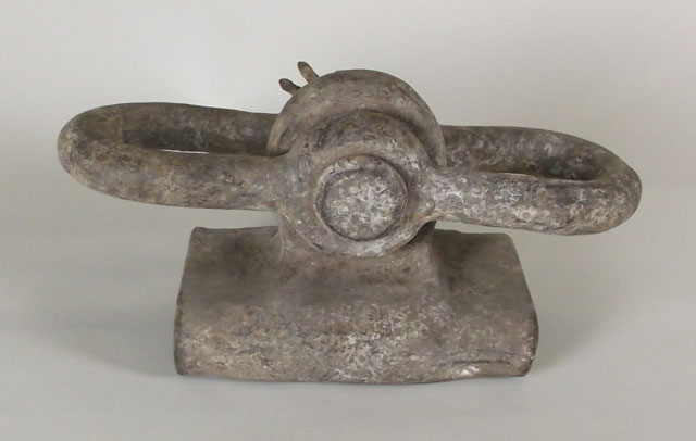 Full-size image
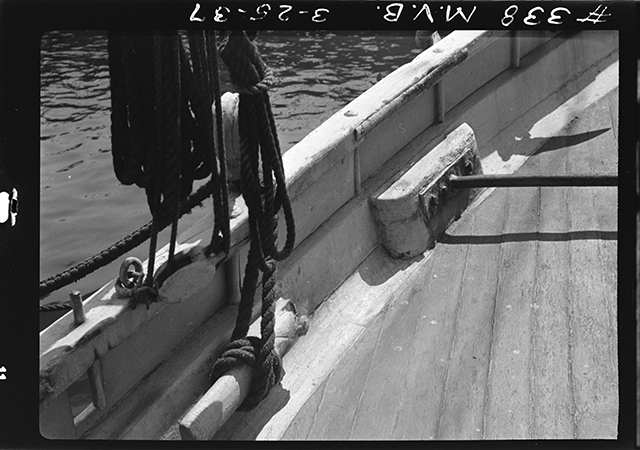 MS63-338 Bugeye Lizzie J Cox
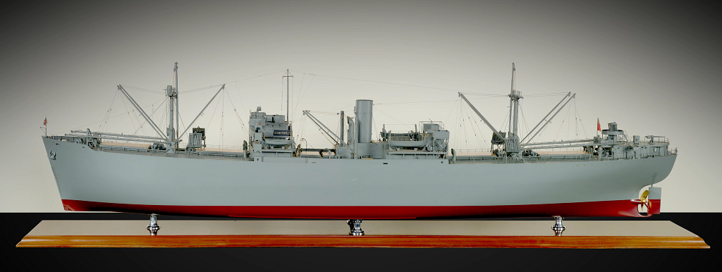 1973.0001.000001_01[1]
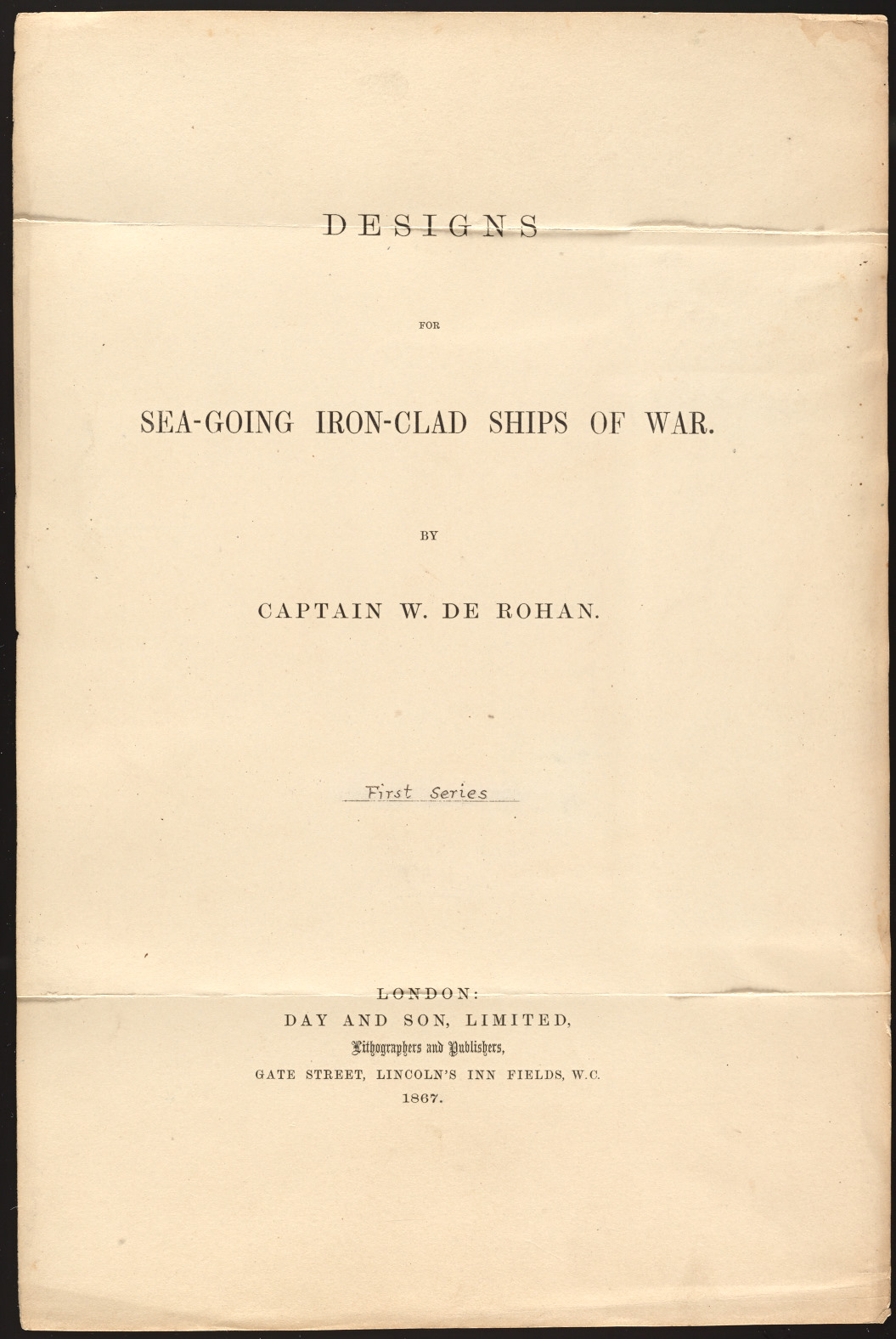 MS0008-03-24.06_01
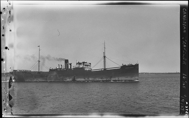 P0006-02-01-368-01
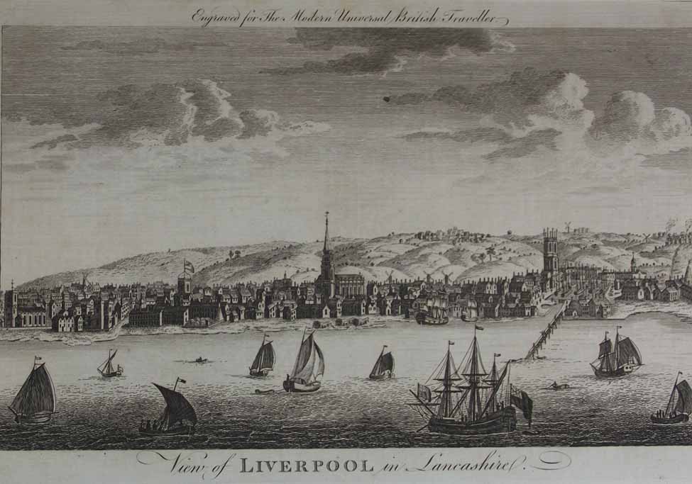 Full-size image
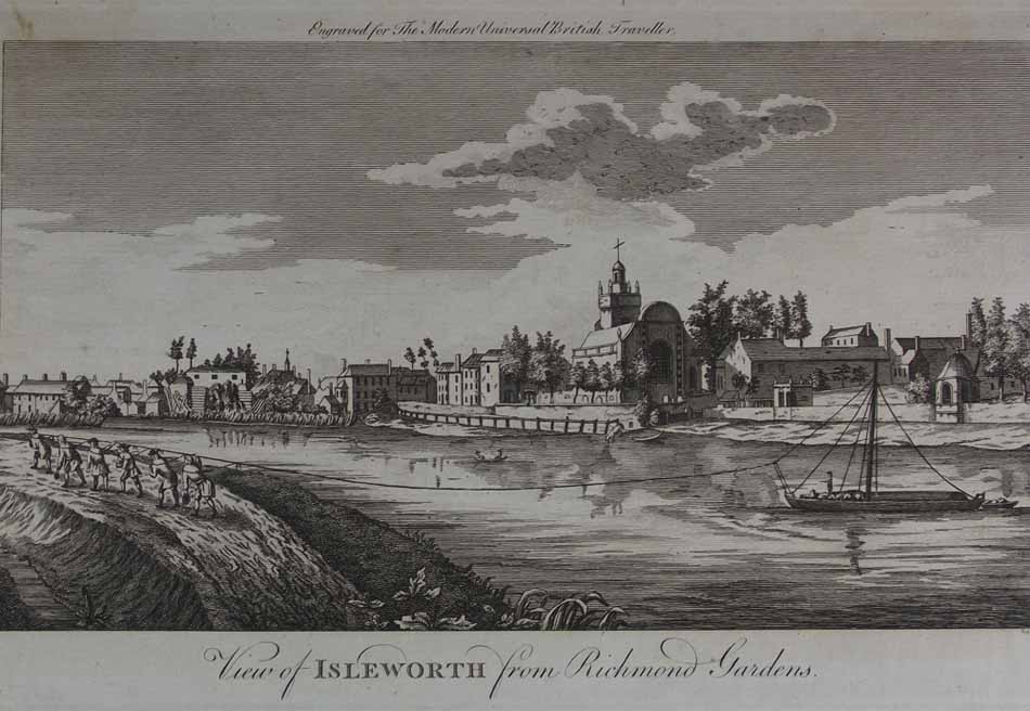 Full-size image
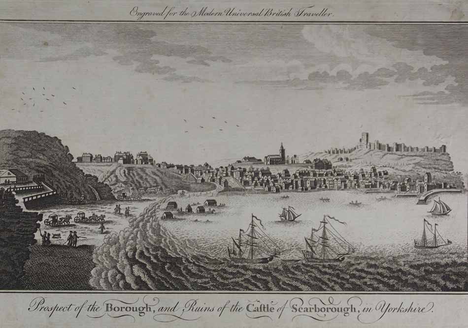 Full-size image
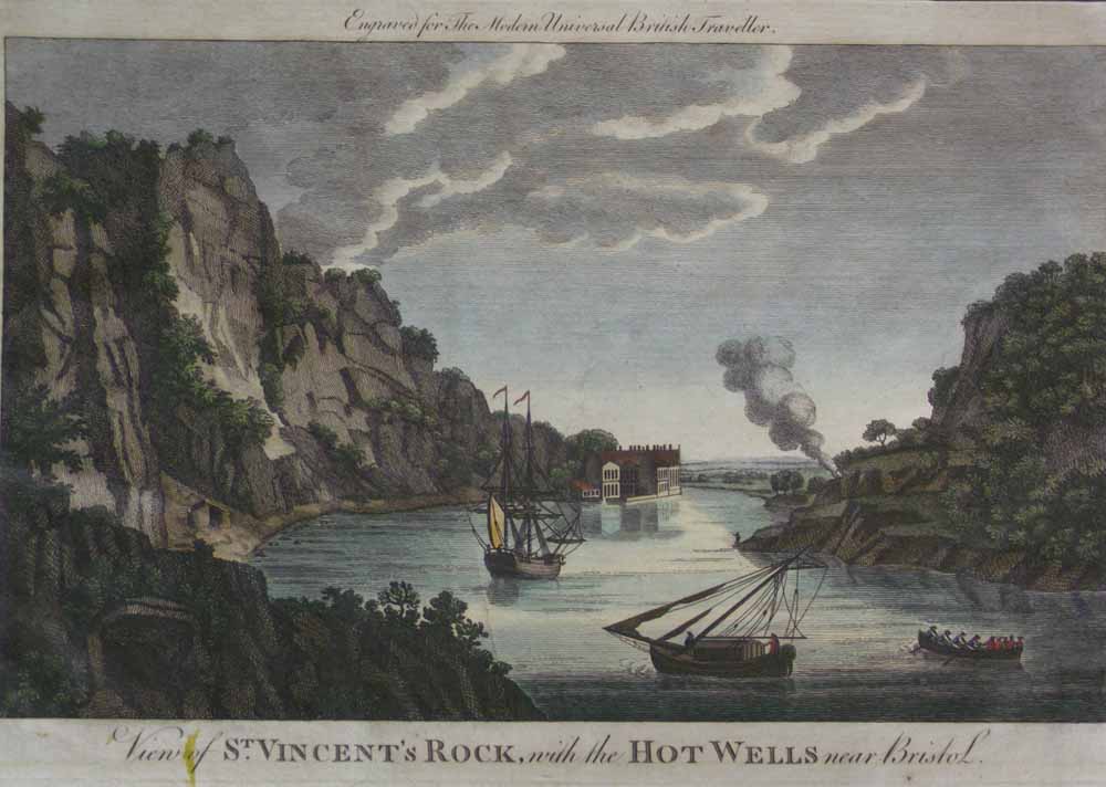 Full-size image
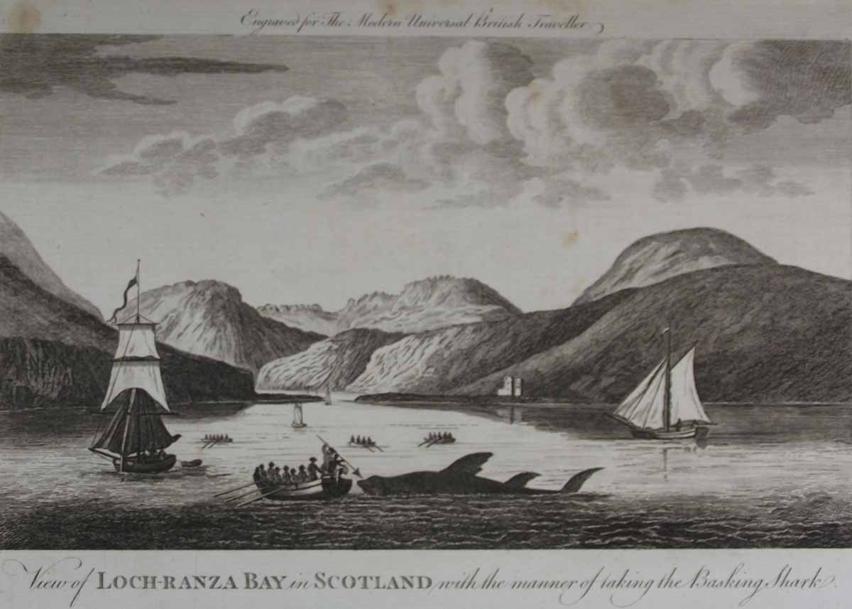 Full-size image
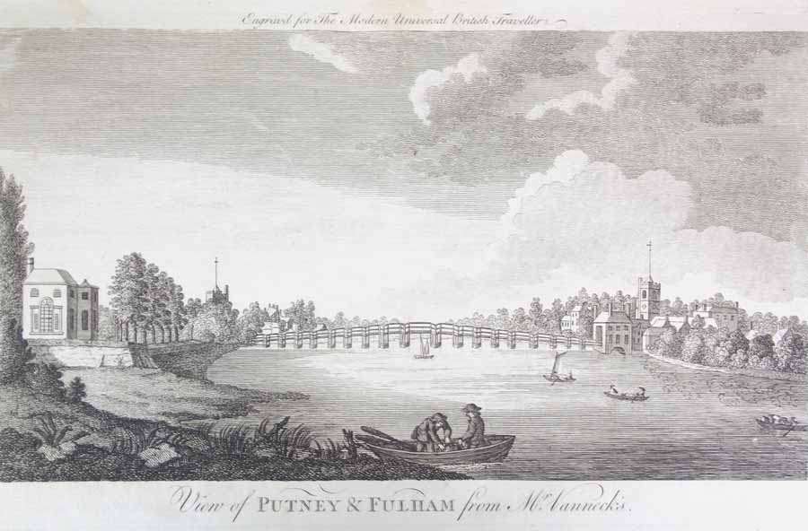 Full-size image
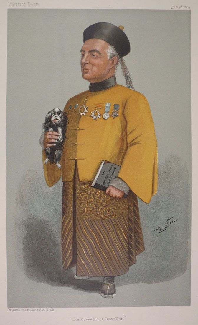 lp4528
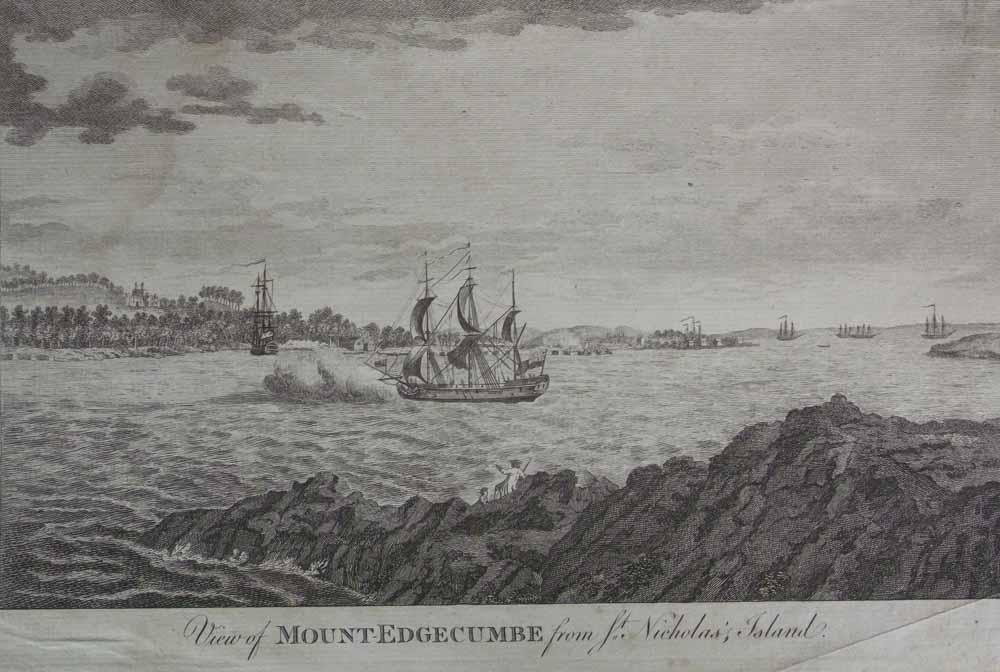 Full-size image
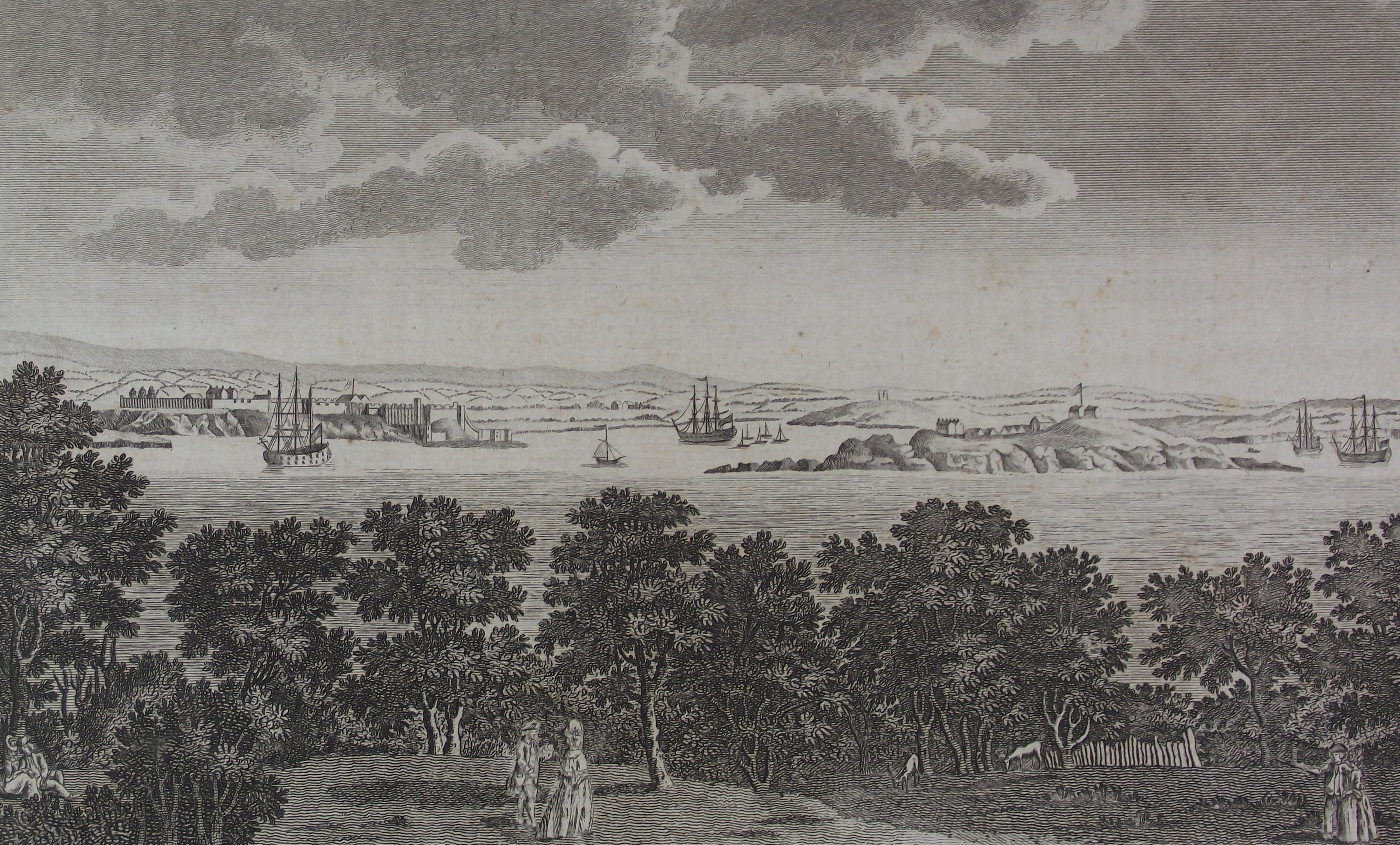 Full-size image
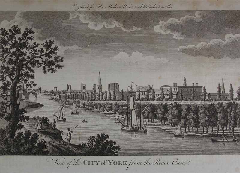 Full-size image
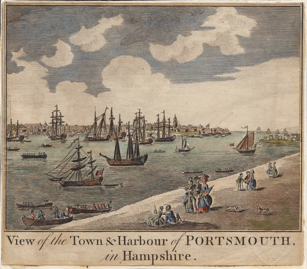 84-69-70
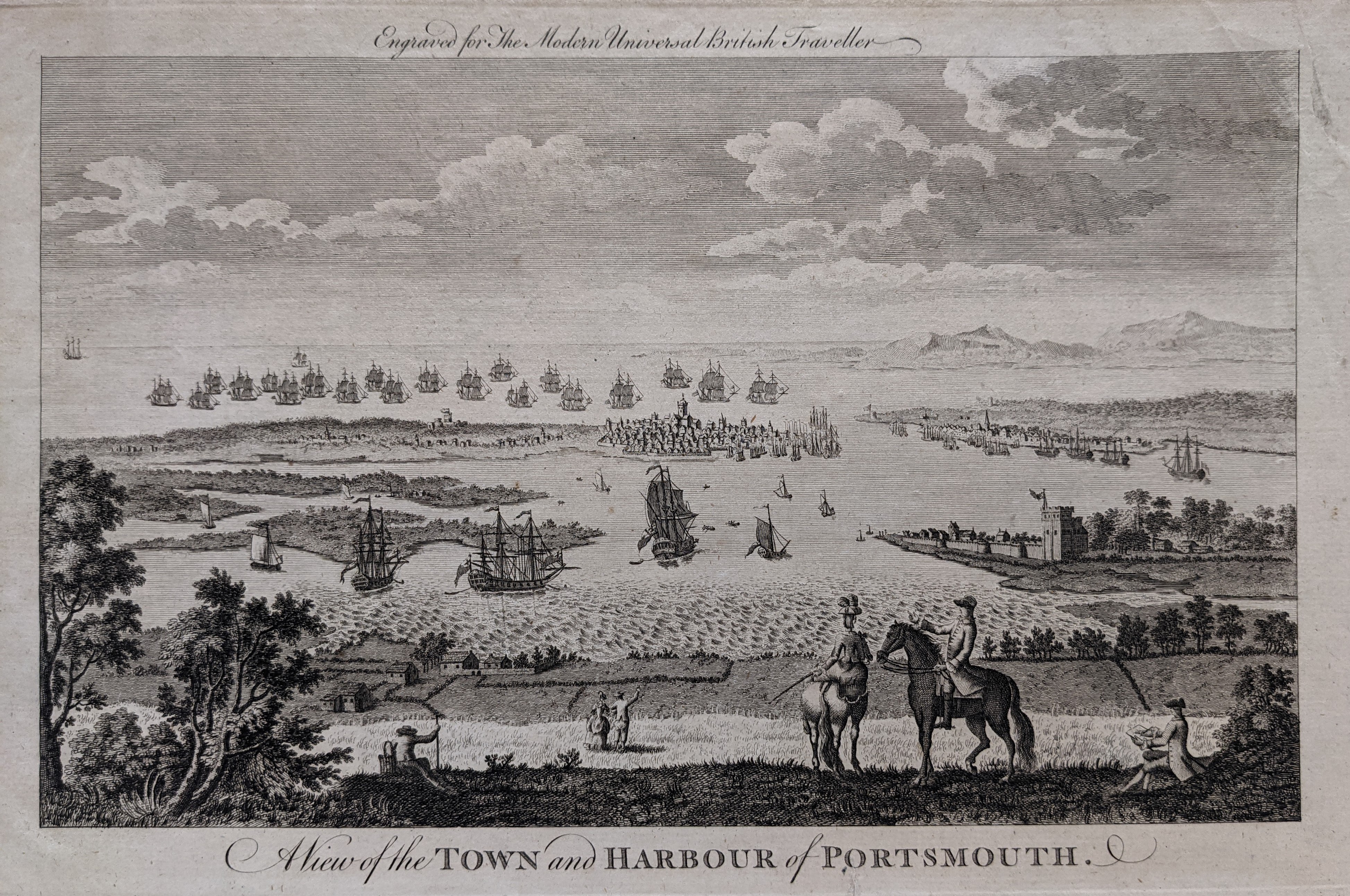 le853
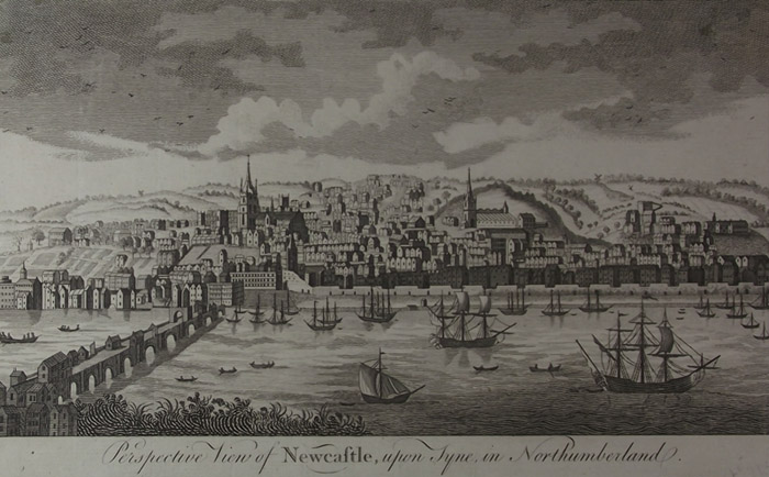 le994
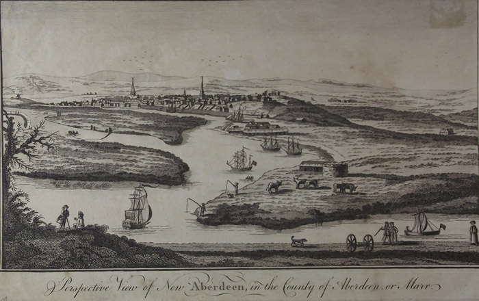 le980
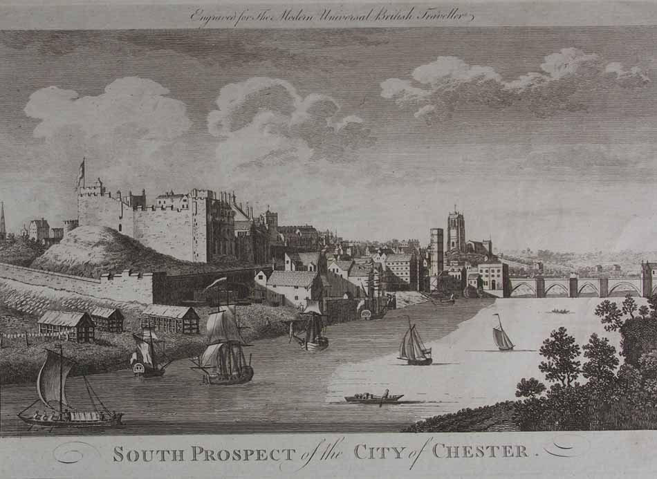 Full-size image
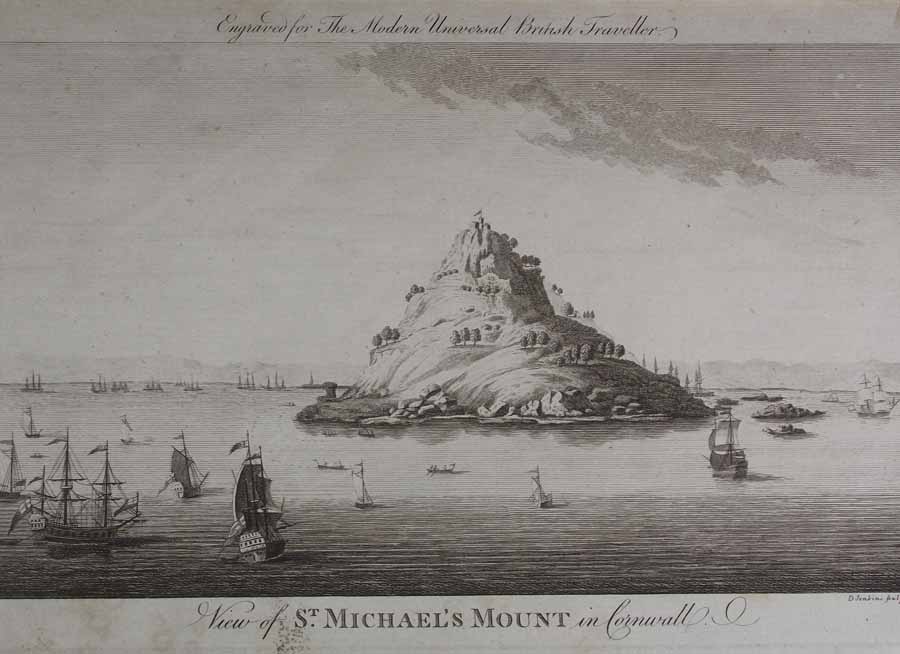 Full-size image
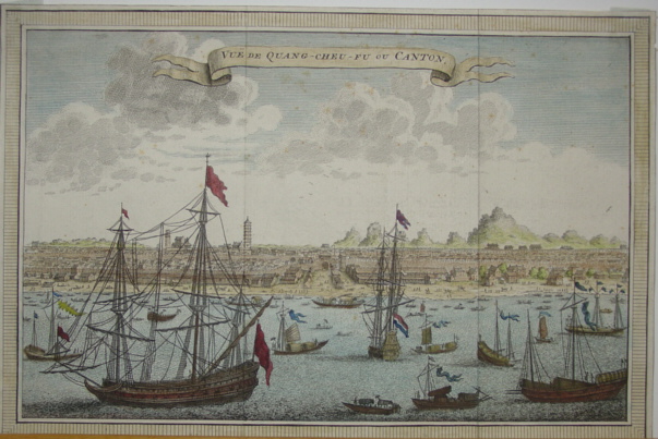 Full-size image
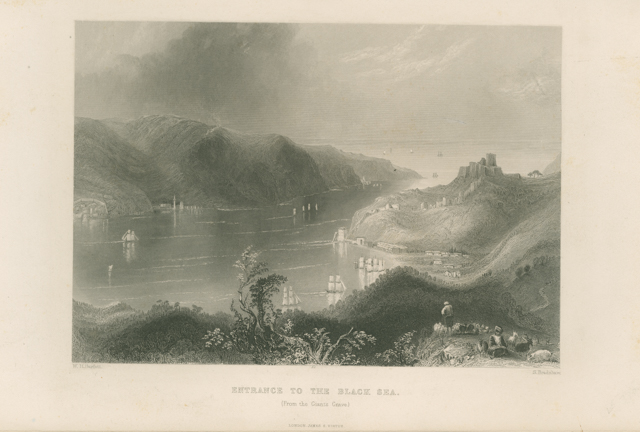 le2694a
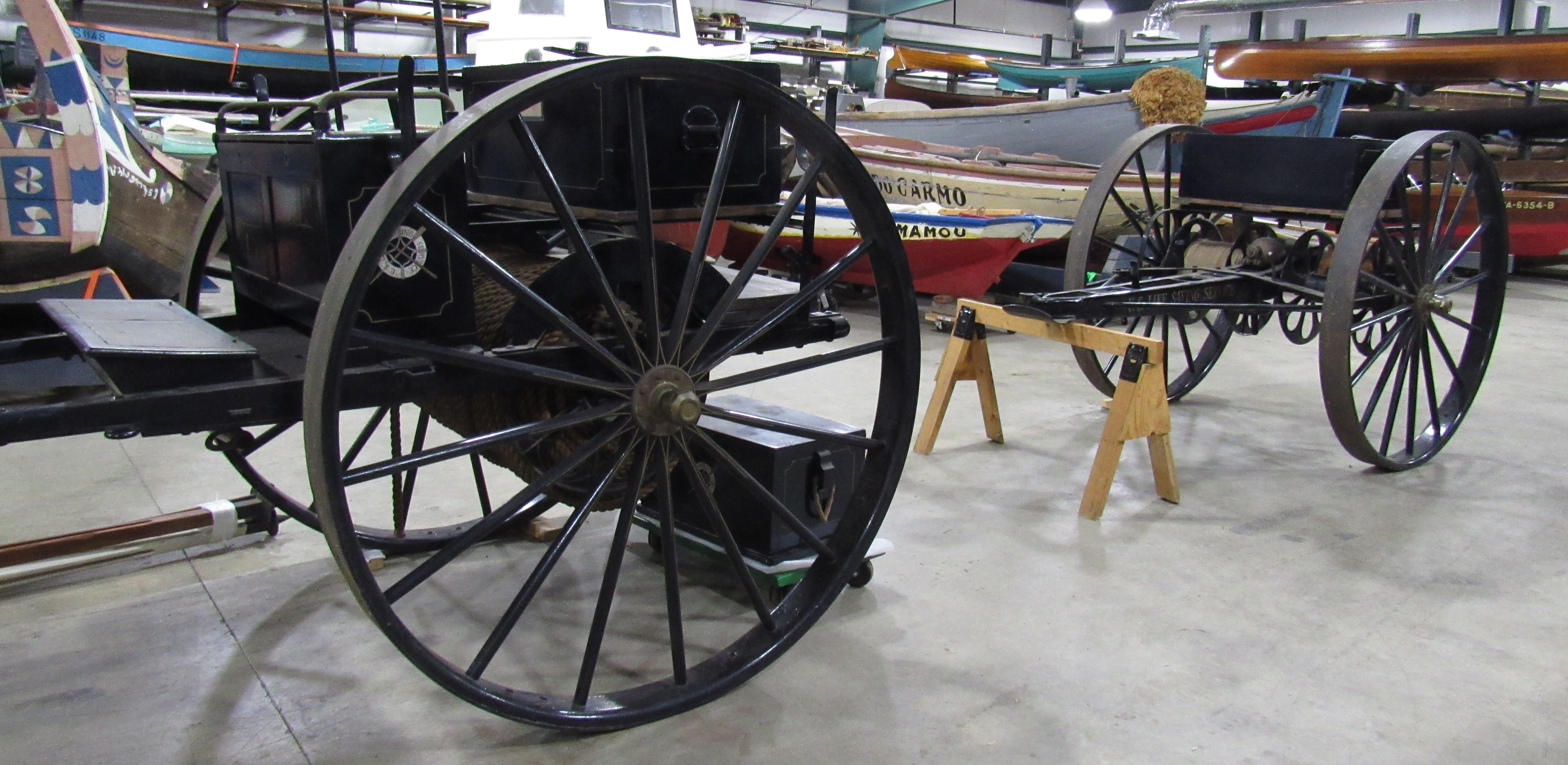 X1
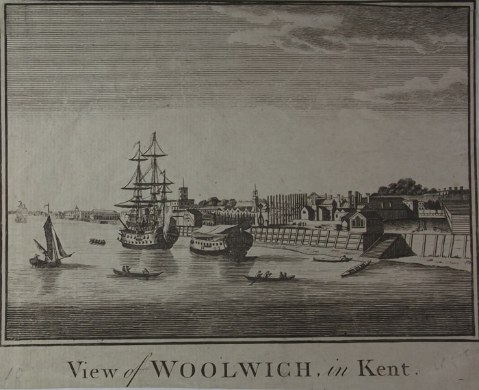 le978
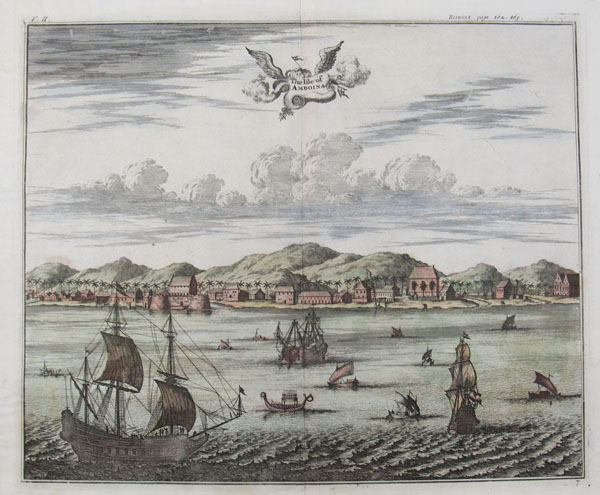 le614
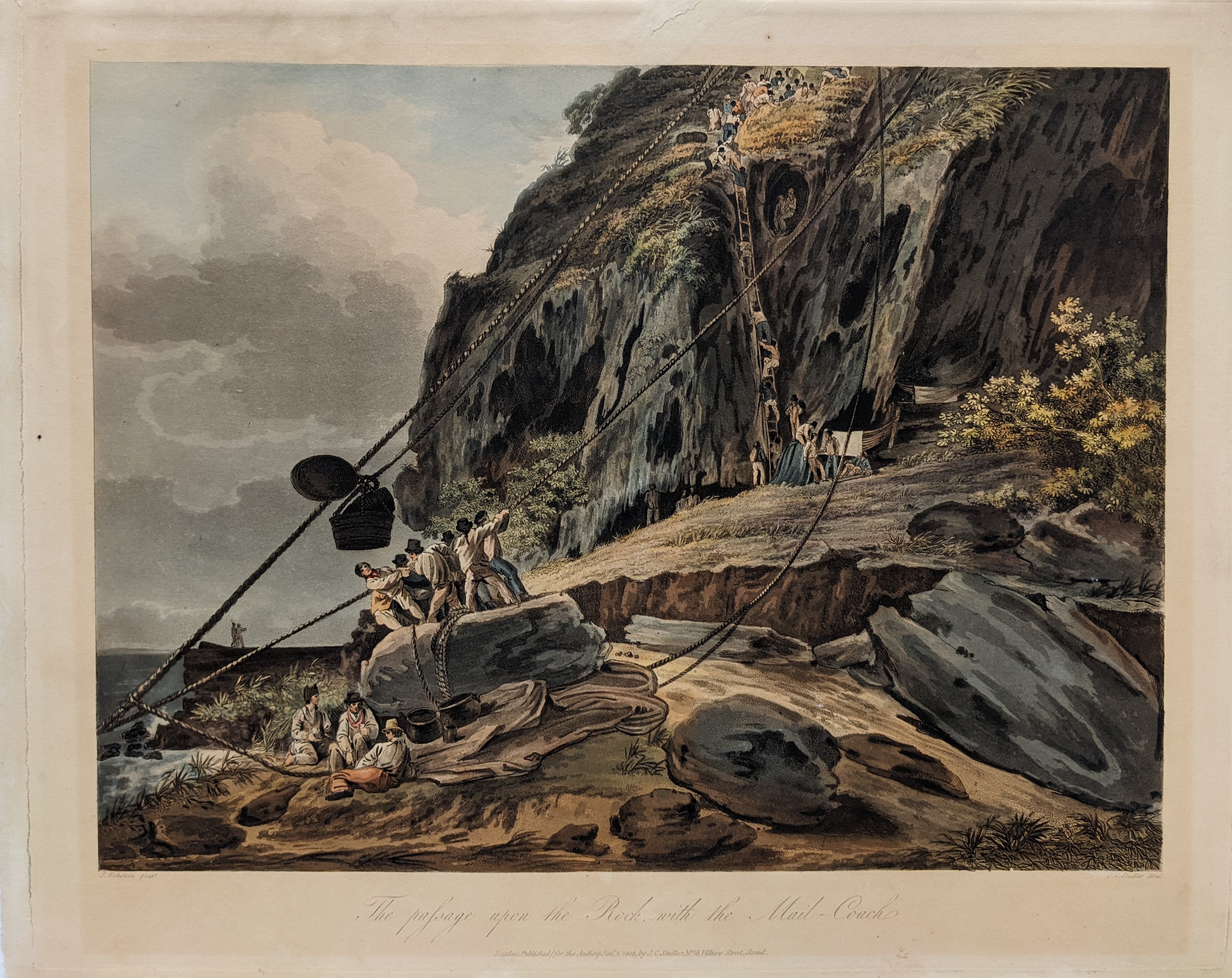 lp3490
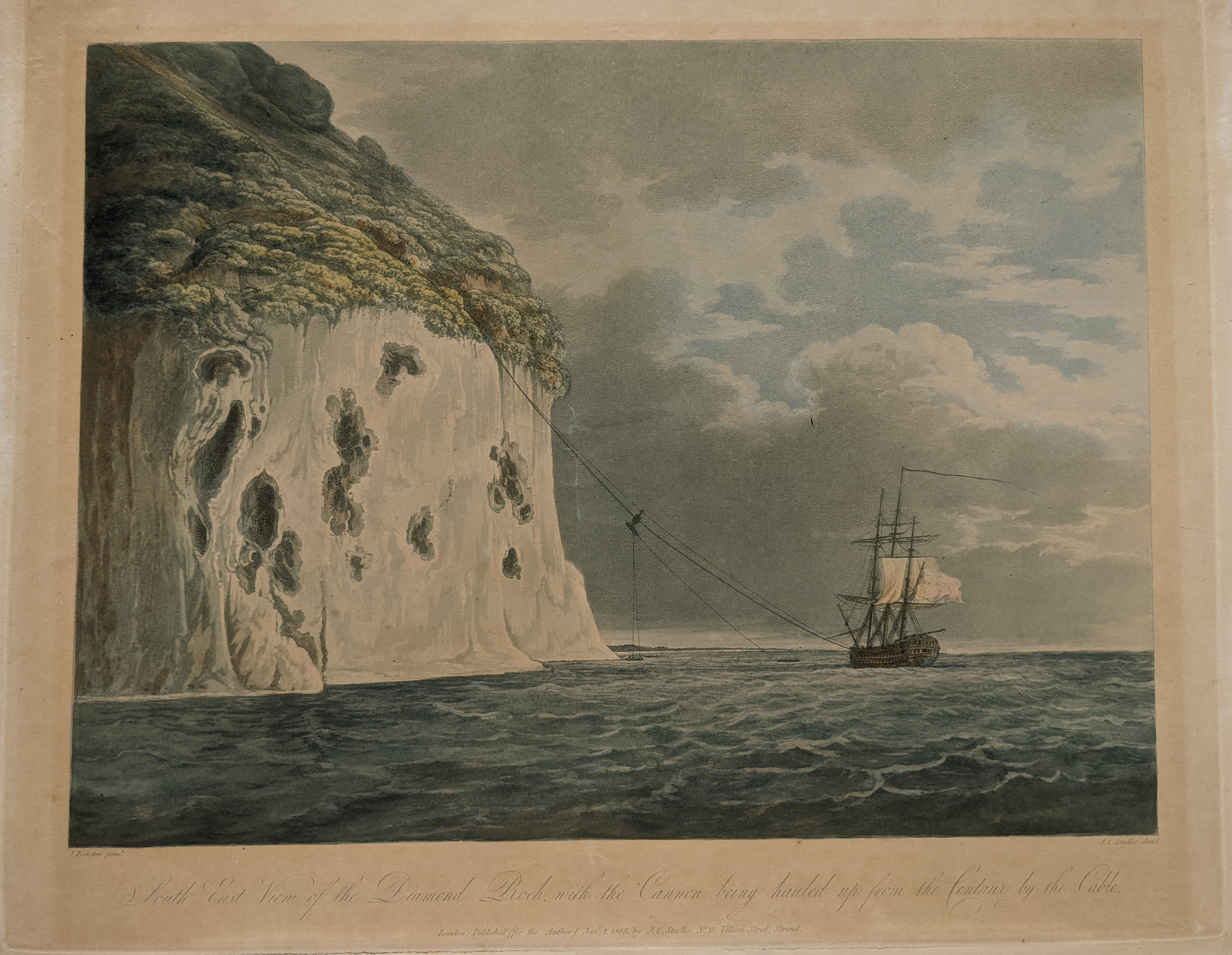 LP3478
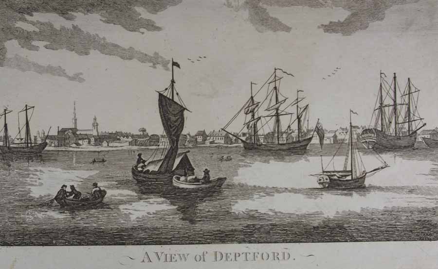 Full-size image
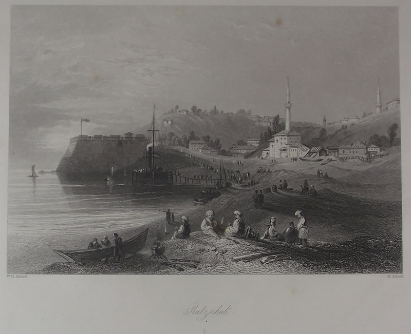 le1717
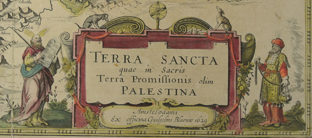 MSM 1-0222 det1
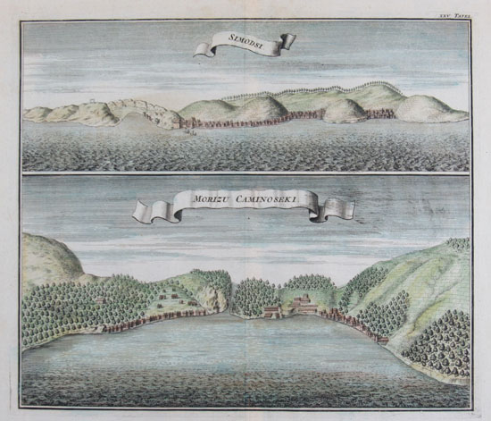 le550
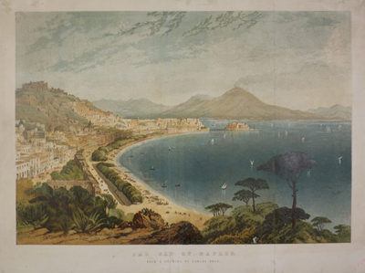 lp696
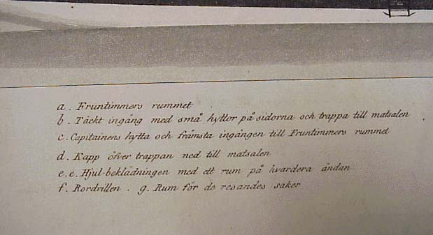 Full-size image
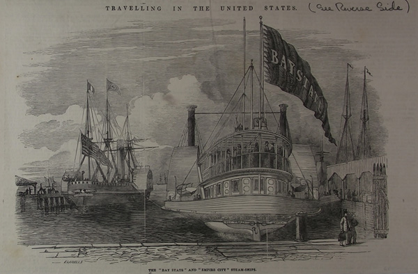 le3164
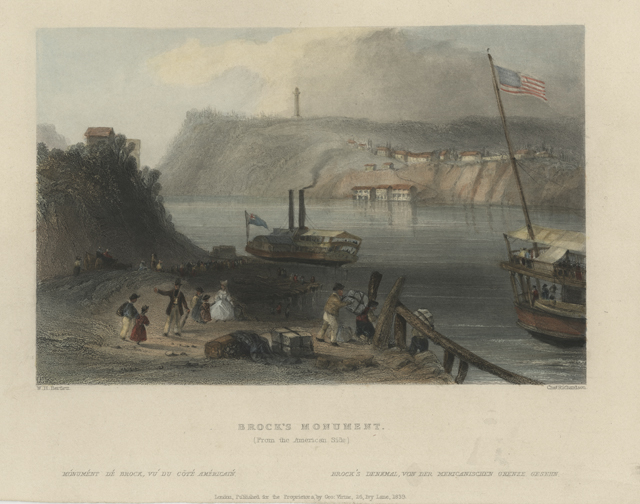 1950.0271.000001